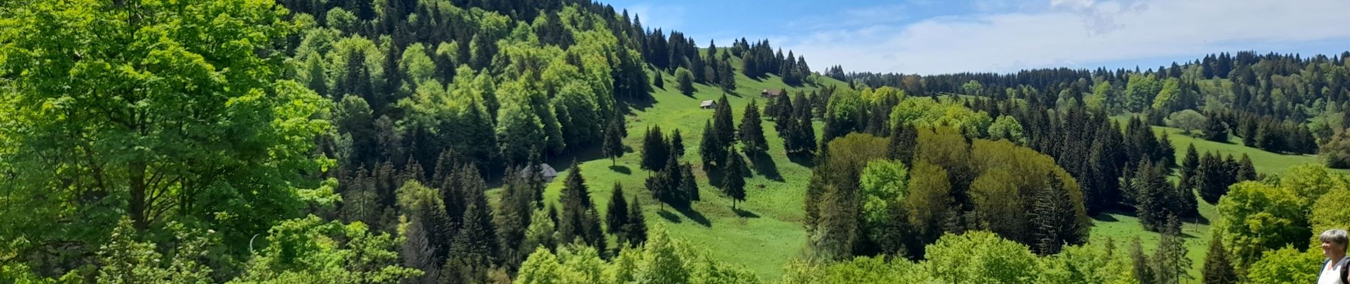
MASSIF DES BAUGES: PLATEAU DU REVARD AUTOUR DE LA CROIX DES BERGERS

djeepee74
User
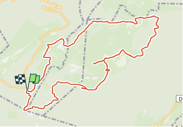

Length
13.8 km

Max alt
1393 m

Uphill gradient
391 m
Km-Effort
19 km

Min alt
1133 m

Downhill gradient
394 m
Boucle
Yes
Creation date :
2021-06-04 07:54:42.189
Updated on :
2021-09-25 18:34:29.536
4h30
Difficulty : Medium

FREE GPS app for hiking
 SityTrail
IGN / Geographical institutes
SityTrail Plus
The world is yours!
About
Trail Walking of 13.8 km to be discovered at Auvergne-Rhône-Alpes, Savoy, Montcel. This trail is proposed by djeepee74.
Description
BOUCLE... live 20210604
Photos


Positioning
Country:
France
Region :
Auvergne-Rhône-Alpes
Department/Province :
Savoy
Municipality :
Montcel
Location:
Unknown
Start:(Dec)
Start:(UTM)
733466 ; 5062891 (31T) N.
Comments