


Coll de l'Ullat - Puig Neulos

patbt
User
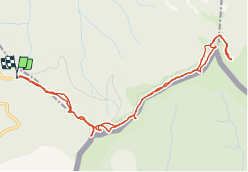

Length
7 km

Max alt
1250 m

Uphill gradient
397 m
Km-Effort
12.3 km

Min alt
936 m

Downhill gradient
394 m
Boucle
Yes
Creation date :
2021-06-05 11:13:04.287
Updated on :
2021-06-05 19:23:37.282
3h33
Difficulty : Easy

FREE GPS app for hiking
 SityTrail
IGN / Geographical institutes
SityTrail Plus
The world is yours!
About
Trail Walking of 7 km to be discovered at Occitania, Pyrénées-Orientales, L'Albère. This trail is proposed by patbt.
Positioning
Country:
France
Region :
Occitania
Department/Province :
Pyrénées-Orientales
Municipality :
L'Albère
Location:
Unknown
Start:(Dec)
Start:(UTM)
493608 ; 4702980 (31T) N.
Comments