Trail Walking Omblèze - Pas de la Douille - Photo
 ajd26
ajd26

User

© OpenStreetMap contributors
Length
Length
12.7 km
Max alt
Max alt
1629 m
Uphill gradient
Uphill gradient
682 m
Km-Effort
Km-Effort  
22 km
Min alt
Min alt
1165 m
Downhill gradient
Downhill gradient
683 m
Boucle
Boucle
Yes
Creation date :
2021-06-10 07:04:32.0
Updated on :
2021-06-11 14:28:52.544

(0 Reviews)

Walking
Walking
4h31
Difficulty : Difficult

Scan this QR Code to open this trail in the SityTrail application

FREE GPS app for hiking

Logo SityTrail SityTrail

IGN / Geographical institutes

Download SityTrail from the App Store Download SityTrail from Google Play

Logo SityTrail SityTrail World

The world is yours!

Download SityTrail from the App Store Download SityTrail from Google Play Download SityTrail on Huawei AppGallery

About

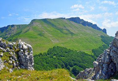
Trail Walking of 12.7 km to be discovered at Auvergne-Rhône-Alpes, Drôme, Omblèze. This trail is proposed by ajd26.

Description

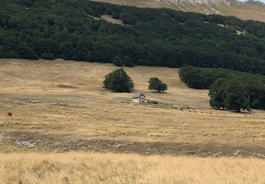
départ après le col de la Bataille et refuge de la Gardiol
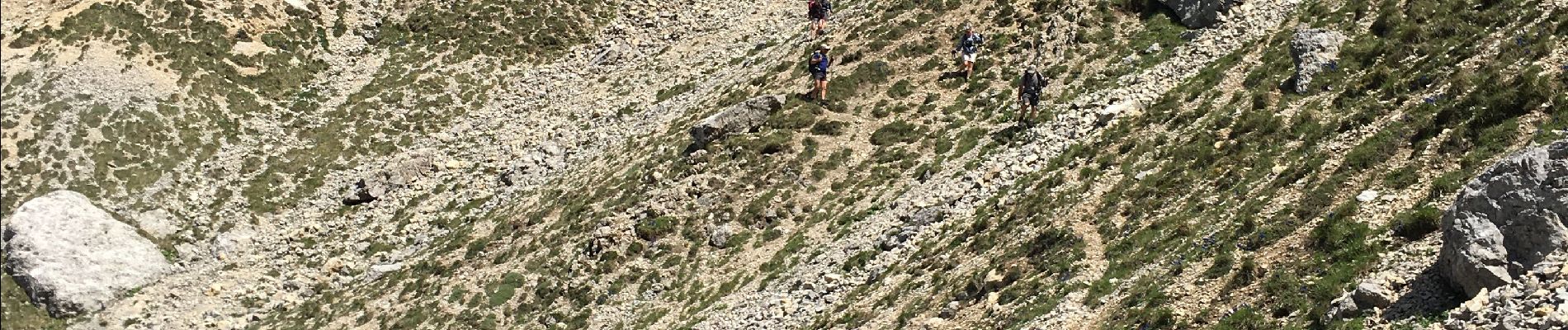
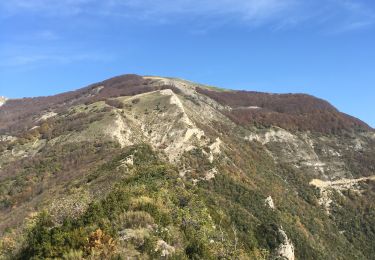
pas de la Ferriere, pas de la Douille et  descente délicate, à faire avec prudence mais panorama magnifique très minéral
pour rejoindre le pas de la couronne, il faut traverser des buis très dense(au km 6,5), le mieux c'est de les contourner par le haut et de redescendre dans le pierrier
ensuite on rejoint le pas de la couronne par un sentier assez bien marqué
randonnée technique à faire avec prudence mais le panorama le vaut bien

Elevation profile

Photos

Positioning

Country:
France
Region :
Auvergne-Rhône-Alpes
Department/Province :
Drôme
Municipality :
Omblèze
Location:
Unknown
Start:(UTM)
679392 ; 4973990 (31T) N.

Trails nearby

Trail Walking Omblèze - 2021-07-26_17h20m33_1627312809705_Plateau d_Ambel 15km.gpx.xml - Photo
Walking
chancha

Walking

Very difficult
(1)
Omblèze, Auvergne-Rhône-Alpes, Drôme, France
14.9 km | 22 km-effort
4h 56min
Yes
Trail Walking Bouvante - 01 - Photo
Walking
Noiraude

Walking

Medium
(1)
Bouvante, Auvergne-Rhône-Alpes, Drôme, France
12.5 km | 19.5 km-effort
5h 7min
Yes
Trail Walking Omblèze - Bec pointu Tête Dame - Photo
Walking
fabal

Walking

Difficult
(1)
Omblèze, Auvergne-Rhône-Alpes, Drôme, France
12.7 km | 26 km-effort
5h 12min
Yes
Trail Walking Bouvante - Font d’Urle les Trois cloches Glacières les Gagères  - Photo
Walking
alinetpierre

Walking

Difficult
Bouvante, Auvergne-Rhône-Alpes, Drôme, France
11.9 km | 17.9 km-effort
4h 4min
Yes
Trail Walking Bouvante - Crête des Gagères - Photo
Walking
Greg813

Walking

Medium
Bouvante, Auvergne-Rhône-Alpes, Drôme, France
8.3 km | 11.6 km-effort
2h 10min
Yes
Trail Nordic walking Bouvante - 202201fontdurle2 - Photo
Nordic walking
michelfehrenbach

Nordic walking

Very easy
Bouvante, Auvergne-Rhône-Alpes, Drôme, France
4.3 km | 6 km-effort
1h 58min
Yes
Trail Walking Saint-Julien-en-Quint - Puy de la Gagere, Porte d’Urle - Photo
Walking
ajd26

Walking

Difficult
Saint-Julien-en-Quint, Auvergne-Rhône-Alpes, Drôme, France
19.3 km | 34 km-effort
6h 45min
Yes
Trail Walking Omblèze - Bec Pointu - Photo
Walking
ajd26

Walking

Medium
Omblèze, Auvergne-Rhône-Alpes, Drôme, France
14.5 km | 27 km-effort
5h 10min
Yes
Trail Walking Bouvante - Tour du Plateau d’Ambel - Photo
Walking
alinetpierre

Walking

Medium
Bouvante, Auvergne-Rhône-Alpes, Drôme, France
18.5 km | 27 km-effort
4h 11min
Yes


Close
My subscriptions