


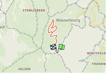
Col de Boenlesgrab- Drei Schöpf - Hansen - Wassmatt - Brunnenmaetlé et retour

patrickbeyrath
User

Length
10.2 km

Max alt
901 m

Uphill gradient
311 m
Km-Effort
14.3 km

Min alt
740 m

Downhill gradient
308 m
Boucle
Yes
Creation date :
2021-06-11 05:42:40.303
Updated on :
2021-06-11 05:52:41.682
3h14
Difficulty : Medium

FREE GPS app for hiking
 SityTrail
IGN / Geographical institutes
SityTrail Plus
The world is yours!
About
Trail On foot of 10.2 km to be discovered at Grand Est, Haut-Rhin, Wasserbourg. This trail is proposed by patrickbeyrath.
Positioning
Country:
France
Region :
Grand Est
Department/Province :
Haut-Rhin
Municipality :
Wasserbourg
Location:
Unknown
Start:(Dec)
Start:(UTM)
361783 ; 5315362 (32T) N.
Comments