


Spitzkoepfe CAF 13/06/21

LaurentGILG
User
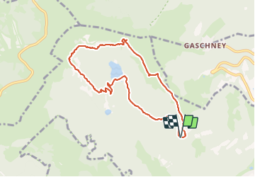

Length
8 km

Max alt
1280 m

Uphill gradient
543 m
Km-Effort
15.3 km

Min alt
893 m

Downhill gradient
538 m
Boucle
Yes
Creation date :
2021-06-13 06:43:21.405
Updated on :
2021-06-14 16:19:47.005
--
Difficulty : Difficult
--
Difficulty : Difficult

FREE GPS app for hiking
 SityTrail
IGN / Geographical institutes
SityTrail Plus
The world is yours!
About
Trail Walking of 8 km to be discovered at Grand Est, Haut-Rhin, Metzeral. This trail is proposed by LaurentGILG.
Positioning
Country:
France
Region :
Grand Est
Department/Province :
Haut-Rhin
Municipality :
Metzeral
Location:
Unknown
Start:(Dec)
Start:(UTM)
353905 ; 5320300 (32U) N.
Comments