


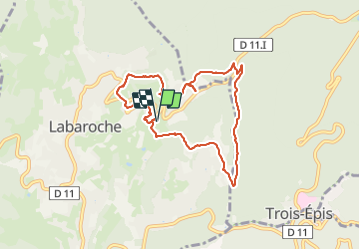
LABAROCHE ÉGLISE

jcschubnel
User

Length
7.6 km

Max alt
708 m

Uphill gradient
391 m
Km-Effort
12.8 km

Min alt
474 m

Downhill gradient
390 m
Boucle
Yes
Creation date :
2021-06-16 11:49:01.32
Updated on :
2021-06-21 16:32:05.536
3h20
Difficulty : Easy

FREE GPS app for hiking
 SityTrail
IGN / Geographical institutes
SityTrail Plus
The world is yours!
About
Trail Walking of 7.6 km to be discovered at Grand Est, Haut-Rhin, Labaroche. This trail is proposed by jcschubnel.
Positioning
Country:
France
Region :
Grand Est
Department/Province :
Haut-Rhin
Municipality :
Labaroche
Location:
Unknown
Start:(Dec)
Start:(UTM)
366516 ; 5330127 (32U) N.
Comments