


Le canal de pisse fort vauban

Vero7684
User
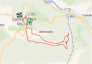

Length
9.9 km

Max alt
1503 m

Uphill gradient
301 m
Km-Effort
13.9 km

Min alt
1260 m

Downhill gradient
315 m
Boucle
No
Creation date :
2021-06-27 11:24:00.399
Updated on :
2021-06-27 14:25:15.315
3h00
Difficulty : Very easy

FREE GPS app for hiking
 SityTrail
IGN / Geographical institutes
SityTrail Plus
The world is yours!
About
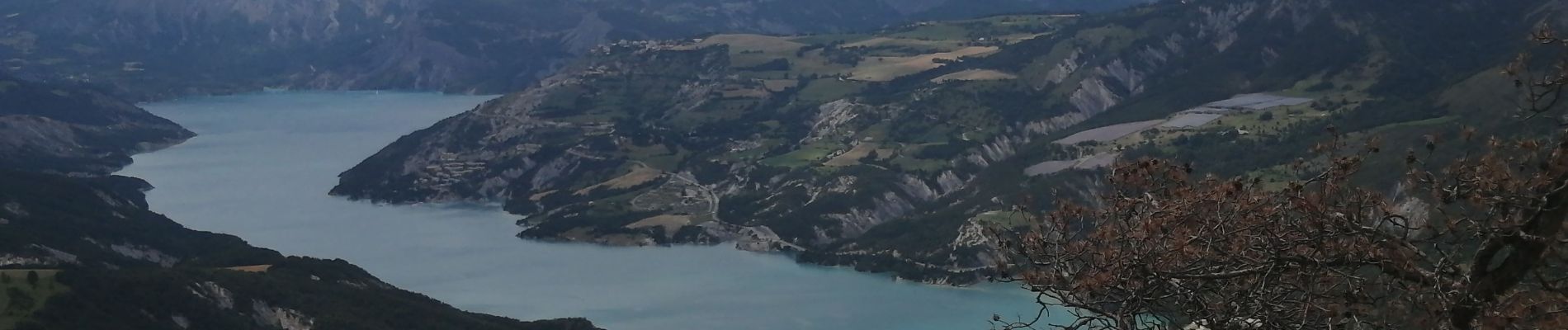
Trail Walking of 9.9 km to be discovered at Provence-Alpes-Côte d'Azur, Alpes-de-Haute-Provence, Ubaye-Serre-Ponçon. This trail is proposed by Vero7684.
Photos


Positioning
Country:
France
Region :
Provence-Alpes-Côte d'Azur
Department/Province :
Alpes-de-Haute-Provence
Municipality :
Ubaye-Serre-Ponçon
Location:
Saint-Vincent-les-Forts
Start:(Dec)
Start:(UTM)
291006 ; 4924266 (32T) N.
Comments