Ubaye-Serre-Ponçon, Alpes-de-Haute-Provence: Best trails, routes and walks

14 comments

Ubaye-Serre-Ponçon: Discover the best trails: 64 hiking trails and 2 bike and mountain-bike routes. All these trails, routes and outdoor activities are available in our SityTrail applications for smartphones and tablets.


The best trails (67)

Trail Walking Ubaye-Serre-Ponçon - MONTCLAR , les Rollands  , canal de la Pisse , Pre Balou , fontaine du loup , fontaine de l mane o l m s - Photo
Walking 15.555
Km

Walking

Medium
(1)
Ubaye-Serre-Ponçon, Provence-Alpes-Côte d'Azur, Alpes-de-Haute-Provence, France
15.6 km | 23 km-effort
4h 22min
588 m
587 m
Yes
RobinMicheline

Trail Walking Ubaye-Serre-Ponçon - le clôt de la cime. - Photo
Walking 12.473
Km

Walking

Easy
(1)
Ubaye-Serre-Ponçon, Provence-Alpes-Côte d'Azur, Alpes-de-Haute-Provence, France
12.5 km | 19.8 km-effort
4h 0min
548 m
545 m
Yes
GILOU440

• départ de la routière .le clôt . borne 1400m col de charamel . belle vue sur le lac.

Trail Walking Ubaye-Serre-Ponçon - Circuit de l'Escoubaye 25 -12- 2014 - Photo
Walking 6.933
Km

Walking

Easy
(1)
Ubaye-Serre-Ponçon, Provence-Alpes-Côte d'Azur, Alpes-de-Haute-Provence, France
6.9 km | 10.1 km-effort
2h 32min
238 m
240 m
Yes
Dervalmarc

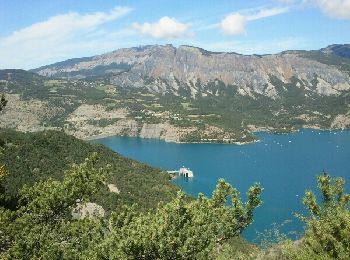
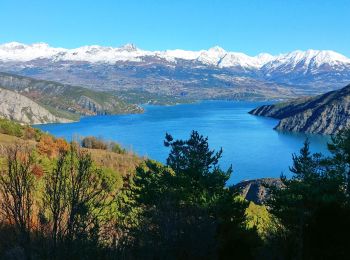
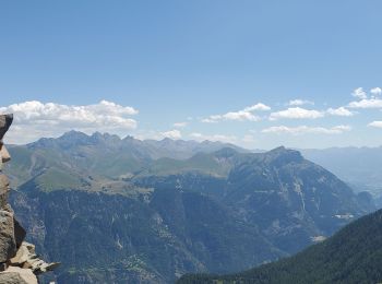
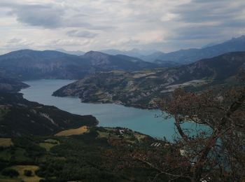
• Très beau sentier en balcon sur le lac de Serre Poncon au départ de la Breole.

Trail Walking Ubaye-Serre-Ponçon - L'Escoubaye - Photo
Walking 5.965
Km

Walking

Medium
(1)
Ubaye-Serre-Ponçon, Provence-Alpes-Côte d'Azur, Alpes-de-Haute-Provence, France
6 km | 9 km-effort
1h 22min
226 m
228 m
Yes
FERAUD

Trail Walking Ubaye-Serre-Ponçon - L'Escoubaye - Photo
Walking 4.528
Km

Walking

Easy
(1)
Ubaye-Serre-Ponçon, Provence-Alpes-Côte d'Azur, Alpes-de-Haute-Provence, France
4.5 km | 7.4 km-effort
2h 0min
215 m
214 m
Yes
saintherant

• Distance : 4.6 kms Dénivelé : 250 m Temps : 1 h 00 Au départ du village de La Bréole, cette randonnée s’adaptera ...

Trail Walking Ubaye-Serre-Ponçon - Du Lac au Village - Photo
Walking 8.836
Km

Walking

Medium
(1)
Ubaye-Serre-Ponçon, Provence-Alpes-Côte d'Azur, Alpes-de-Haute-Provence, France
8.8 km | 15.1 km-effort
3h 40min
472 m
471 m
Yes
saintherant

• Distance : 8.9 kms Dénivelé : 500 m Temps : 3 h 30 Au départ de la plage de Saint Vincent les Forts (800 m) ce ci...

Trail Walking Ubaye-Serre-Ponçon - Circuit de Costebelle - Photo
Walking 8.172
Km

Walking

Medium
(2)
Ubaye-Serre-Ponçon, Provence-Alpes-Côte d'Azur, Alpes-de-Haute-Provence, France
8.2 km | 12.8 km-effort
2h 30min
347 m
347 m
Yes
saintherant

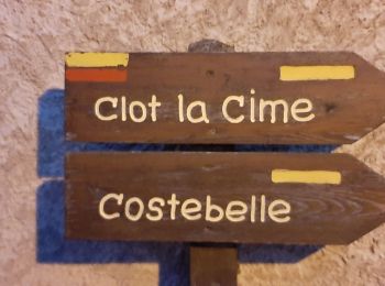
• Distance : 8.2 kms Dénivelé : 350 m Temps : 3 h 00 Au départ du village de La Bréole, le circuit de Costebelle vo...

Trail Walking Ubaye-Serre-Ponçon - S VINCENT LES FORTS . CANAL DE LA PISSE . FONTAINE DE LANE . FONTAINE DU LOIUP . O L S. NZ . - Photo
Walking 8.52
Km

Walking

Medium
Ubaye-Serre-Ponçon, Provence-Alpes-Côte d'Azur, Alpes-de-Haute-Provence, France
8.5 km | 13.9 km-effort
2h 46min
404 m
402 m
Yes
RobinMicheline

Trail Walking Ubaye-Serre-Ponçon - Bivouac Dormillouse - Photo
Walking 16.9
Km
GUIDE

Walking

Very difficult
Ubaye-Serre-Ponçon, Provence-Alpes-Côte d'Azur, Alpes-de-Haute-Provence, France
16.9 km | 36 km-effort
7h 5min
1408 m
1407 m
Yes
David25400

Trail Walking Ubaye-Serre-Ponçon - rechmardi - Photo
Walking 4.426
Km

Walking

Very easy
Ubaye-Serre-Ponçon, Provence-Alpes-Côte d'Azur, Alpes-de-Haute-Provence, France
4.4 km | 6.7 km-effort
2h 19min
171 m
179 m
Yes
rolandum

Trail Walking Ubaye-Serre-Ponçon - Clot la Cime - Photo
Walking 6.665
Km
GUIDE

Walking

Very easy
Ubaye-Serre-Ponçon, Provence-Alpes-Côte d'Azur, Alpes-de-Haute-Provence, France
6.7 km | 11.3 km-effort
2h 54min
346 m
349 m
Yes
David25400

Trail Walking Ubaye-Serre-Ponçon - LA BREOLE  . Clot la Cime , col de Charamel o l s - Photo
Walking 13.062
Km

Walking

Medium
Ubaye-Serre-Ponçon, Provence-Alpes-Côte d'Azur, Alpes-de-Haute-Provence, France
13.1 km | 22 km-effort
3h 52min
695 m
696 m
Yes
RobinMicheline

Trail Walking Ubaye-Serre-Ponçon - 04 - pres col St Jean - Canal de la Pisse. Pre Balou, rocher du Joug, fontaine du Loup - Photo
Walking 15.2
Km

Walking

Medium
Ubaye-Serre-Ponçon, Provence-Alpes-Côte d'Azur, Alpes-de-Haute-Provence, France
15.2 km | 23 km-effort
6h 0min
597 m
597 m
Yes
chris13370

Trail Walking Ubaye-Serre-Ponçon - 20191203_Espinasse L'escoubaye - Photo
Walking 16.315
Km

Walking

Medium
Ubaye-Serre-Ponçon, Provence-Alpes-Côte d'Azur, Alpes-de-Haute-Provence, France
16.3 km | 24 km-effort
5h 50min
572 m
572 m
Yes
PapouBertrand

Trail Walking Ubaye-Serre-Ponçon - 20191112_Le Fein La Tour Vauban - Photo
Walking 11.438
Km

Walking

Very easy
Ubaye-Serre-Ponçon, Provence-Alpes-Côte d'Azur, Alpes-de-Haute-Provence, France
11.4 km | 18.7 km-effort
4h 39min
547 m
533 m
Yes
PapouBertrand

Trail Walking Ubaye-Serre-Ponçon - Batterie du Chatelard - Photo
Walking 2.04
Km

Walking

Easy
(1)
Ubaye-Serre-Ponçon, Provence-Alpes-Côte d'Azur, Alpes-de-Haute-Provence, France
2 km | 3 km-effort
1h 0min
74 m
76 m
Yes
saintherant

• Distance : 2 kms Dénivelé : 100 m Temps : 1 h 00 Au départ du Clot du Dou, cette randonnée s’adresse à tous les p...

Trail Walking Ubaye-Serre-Ponçon - St Vincent les forts montagnette  - Photo
Walking 13.656
Km

Walking

Difficult
Ubaye-Serre-Ponçon, Provence-Alpes-Côte d'Azur, Alpes-de-Haute-Provence, France
13.7 km | 27 km-effort
8h 17min
978 m
975 m
Yes
Danielba

Trail Walking Ubaye-Serre-Ponçon - lac St Léger par les goirands - Photo
Walking 12.254
Km

Walking

Medium
Ubaye-Serre-Ponçon, Provence-Alpes-Côte d'Azur, Alpes-de-Haute-Provence, France
12.3 km | 18.3 km-effort
4h 29min
455 m
458 m
Yes
Yves Locati

Trail Walking Ubaye-Serre-Ponçon - Camping Le Lac - Tour Vauban - AR - Photo
Walking 11.661
Km

Walking

Medium
Ubaye-Serre-Ponçon, Provence-Alpes-Côte d'Azur, Alpes-de-Haute-Provence, France
11.7 km | 18.9 km-effort
3h 30min
542 m
541 m
Yes
Maca8284

Trail Walking Ubaye-Serre-Ponçon - Le canal de pisse fort vauban - Photo
Walking 9.856
Km

Walking

Very easy
Ubaye-Serre-Ponçon, Provence-Alpes-Côte d'Azur, Alpes-de-Haute-Provence, France
9.9 km | 13.9 km-effort
3h 0min
301 m
315 m
No
Vero7684

20 trails displayed on 67

FREE GPS app for hiking

Logo SityTrail SityTrail

IGN / Geographical institutes

Download SityTrail from the App Store Download SityTrail from Google Play

Logo SityTrail SityTrail World

The world is yours!

Download SityTrail from the App Store Download SityTrail from Google Play Download SityTrail on Huawei AppGallery

Activities

Nearby regions

Close
My subscriptions