


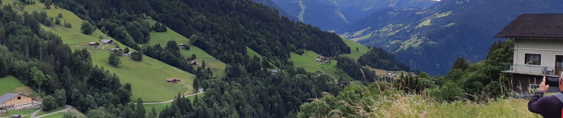
LE SENTIER DES COTES A HAUTELUCE

walrou63
User
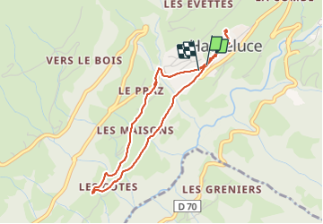

Length
4.2 km

Max alt
1175 m

Uphill gradient
120 m
Km-Effort
5.8 km

Min alt
1061 m

Downhill gradient
120 m
Boucle
Yes
Creation date :
2021-06-30 13:15:19.607
Updated on :
2021-07-15 09:40:11.04
1h45
Difficulty : Easy

FREE GPS app for hiking
 SityTrail
IGN / Geographical institutes
SityTrail Plus
The world is yours!
About
Trail Walking of 4.2 km to be discovered at Auvergne-Rhône-Alpes, Savoy, Hauteluce. This trail is proposed by walrou63.
Photos


Positioning
Country:
France
Region :
Auvergne-Rhône-Alpes
Department/Province :
Savoy
Municipality :
Hauteluce
Location:
Unknown
Start:(Dec)
Start:(UTM)
312050 ; 5069038 (32T) N.
Comments