


Lac ibardin

yoye
User
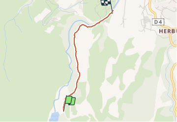

Length
2.1 km

Max alt
268 m

Uphill gradient
0 m
Km-Effort
2.7 km

Min alt
81 m

Downhill gradient
183 m
Boucle
No
Creation date :
2021-07-01 08:04:16.0
Updated on :
2021-07-01 08:45:05.697
41m
Difficulty : Easy

FREE GPS app for hiking
 SityTrail
IGN / Geographical institutes
SityTrail Plus
The world is yours!
About
Trail Walking of 2.1 km to be discovered at New Aquitaine, Pyrénées-Atlantiques, Urrugne. This trail is proposed by yoye.
Description
Facile
Positioning
Country:
France
Region :
New Aquitaine
Department/Province :
Pyrénées-Atlantiques
Municipality :
Urrugne
Location:
Unknown
Start:(Dec)
Start:(UTM)
604914 ; 4797541 (30T) N.
Comments