Trail Walking Aragnouet - Le lac de l'Oule variante en passant par le bas du barrage - Photo

Le lac de l'Oule variante en passant par le bas du barrage

 jp0065
jp0065

User

© OpenStreetMap contributors
Length
Length
10.5 km
Max alt
Max alt
1861 m
Uphill gradient
Uphill gradient
396 m
Km-Effort
Km-Effort  
15.8 km
Min alt
Min alt
1597 m
Downhill gradient
Downhill gradient
395 m
Boucle
Boucle
Yes
Creation date :
2021-07-01 05:52:00.0
Updated on :
2021-07-02 13:04:01.572

(0 Reviews)

Walking
Walking
3h00
Difficulty : Easy

Scan this QR Code to open this trail in the SityTrail application

FREE GPS app for hiking

Logo SityTrail SityTrail

IGN / Geographical institutes

Download SityTrail from the App Store Download SityTrail from Google Play

Logo SityTrail SityTrail World

The world is yours!

Download SityTrail from the App Store Download SityTrail from Google Play Download SityTrail on Huawei AppGallery

About

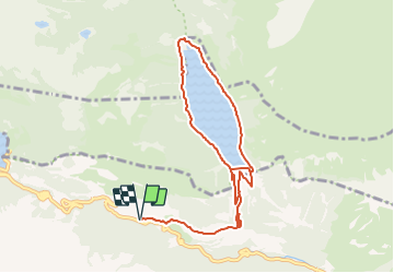
Trail Walking of 10.5 km to be discovered at Occitania, Hautespyrenees, Aragnouet. This trail is proposed by jp0065.

Description

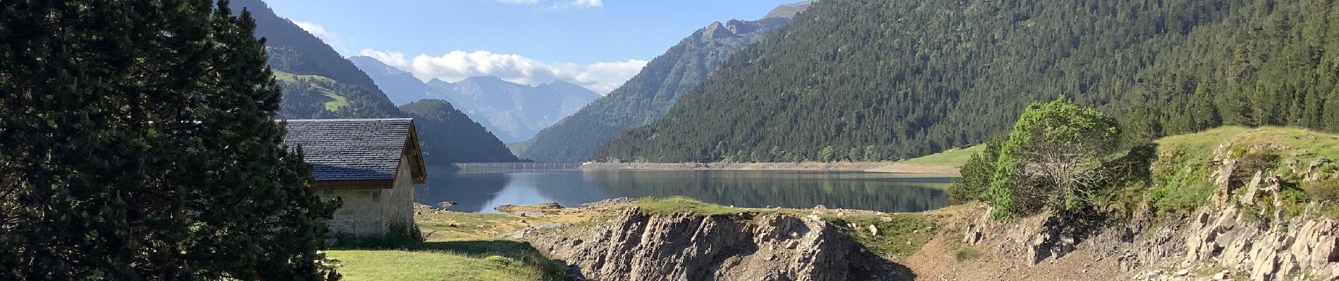
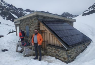
Randonnée de 11 KM, durée 3h
Départ du parking d'Artigusse, parking payant  (7€ la première journée) du 19 juin au 19 septembre (pour information amende 45€).
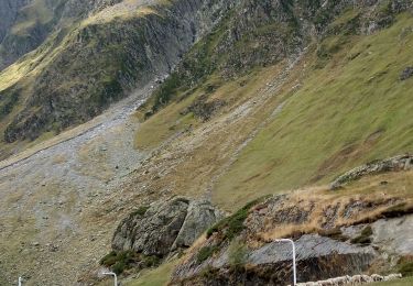
Altitude minimale 1597m, altitude maximale 1597, dénivelé   396 m et dénivelé - 395m

Vidéo de la randonnée : https://youtu.be/VWYXIwa6Okc

Elevation profile

Photos

Positioning

Country:
France
Region :
Occitania
Department/Province :
Hautespyrenees
Municipality :
Aragnouet
Location:
Unknown
Start:(UTM)
270274 ; 4744570 (31T) N.

Trails nearby

Trail Walking Aragnouet - Pic d'Estaragne et Pic Cambieil - Photo
Walking
tracegps

Walking

Very difficult
(2)
Aragnouet, Occitania, Hautespyrenees, France
11.6 km | 28 km-effort
3h 40min
Yes
Trail Walking Saint-Lary-Soulan - Le soum de Monpelat par les laquettes (Néouvielle) - Photo
Walking
tracegps

Walking

Difficult
(2)
Saint-Lary-Soulan, Occitania, Hautespyrenees, France
11.5 km | 21 km-effort
3h 10min
Yes
Trail Walking Aragnouet - Pic Barrosa, Soum Barrosa et Pic de Port de Vieux - Photo
Walking
tracegps

Walking

Very difficult
(1)
Aragnouet, Occitania, Hautespyrenees, France
22 km | 42 km-effort
9h 0min
Yes
Trail Walking Aragnouet - Lac de Barroude par Aragnouet - Photo
Walking
tracegps

Walking

Difficult
(1)
Aragnouet, Occitania, Hautespyrenees, France
8.2 km | 18.3 km-effort
3h 0min
No
Trail Walking Aragnouet - Hourquettes de Héas et de Chermentas en boucle depuis Piau Engaly - Photo
Walking
2041

Walking

Medium
(3)
Aragnouet, Occitania, Hautespyrenees, France
12.4 km | 25 km-effort
5h 3min
Yes
Trail Walking Aragnouet - M005-Circuit Barroude-Port Vieux - Photo
Walking
Polo-31

Walking

Difficult
(1)
Aragnouet, Occitania, Hautespyrenees, France
22 km | 41 km-effort
8h 11min
Yes
Trail Walking Saint-Lary-Soulan - Lac d''Oredon - lac d''Aubert - Photo
Walking
faust1959

Walking

Very easy
(1)
Saint-Lary-Soulan, Occitania, Hautespyrenees, France
4.2 km | 7.4 km-effort
Unknown
No
Trail Snowshoes Aragnouet - Lac de Badet - Photo
Snowshoes
PVERTICAL

Snowshoes

Medium
Aragnouet, Occitania, Hautespyrenees, France
7.9 km | 12.9 km-effort
3h 26min
Yes
Trail Walking Aragnouet - 2023-09-14 Piau Engaly - Hourquette de Heas - Photo
Walking
Mich&Agnès

Walking

Difficult
Aragnouet, Occitania, Hautespyrenees, France
13.3 km | 25 km-effort
5h 28min
Yes


Close
My subscriptions