Trail Walking Beaufort - 2021-07-05_19h47m20_gpx-file - Photo

2021-07-05_19h47m20_gpx-file

© OpenStreetMap contributors
Length
Length
12.9 km
Max alt
Max alt
416 m
Uphill gradient
Uphill gradient
292 m
Km-Effort
Km-Effort  
16.8 km
Min alt
Min alt
297 m
Downhill gradient
Downhill gradient
291 m
Boucle
Boucle
Yes
Creation date :
2021-07-05 17:47:20.574
Updated on :
2023-06-11 15:52:12.044

(2 Reviews)

Walking
Walking
3h48
Difficulty : Medium

Scan this QR Code to open this trail in the SityTrail application

FREE GPS app for hiking

Logo SityTrail SityTrail

IGN / Geographical institutes

Download SityTrail from the App Store Download SityTrail from Google Play

Logo SityTrail SityTrail Plus

The world is yours!

Download SityTrail from the App Store Download SityTrail from Google Play Download SityTrail on Huawei AppGallery

About

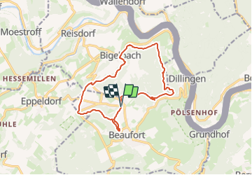
Trail Walking of 12.9 km to be discovered at Unknown, Canton Echternach, Beaufort. This trail is proposed by mumu.larandonneuse.

Description

📌 au centre de Beaufort ou directement du 🏕 Camping Park Beaufort.
➡️ Beau parcours forestier avec quelques formations rocheuses et de belles vues sur les vallées de l'Our et la Sûre, traversant Bigelbach.
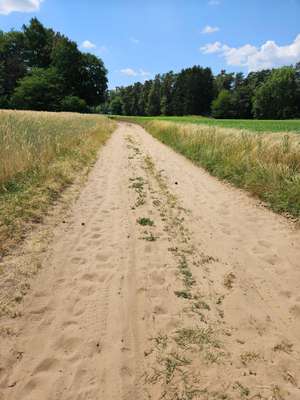
Elevation profile

Photos

Positioning

Country:
Luxembourg
Region :
Unknown
Department/Province :
Canton Echternach
Municipality :
Beaufort
Location:
Unknown
Start:(UTM)
304973 ; 5524798 (32U) N.

Comments

Please log in to post a review or rate the element


Superbe ballade. Merci.


Superbe parcours forestier 🌳🌲 sans difficultés.


Close
My subscriptions