![](/images/other/stat-length.png)
![Trail Walking Beaufort - 2021-07-05_19h47m20_gpx-file - Photo](https://media.geolcdn.com/t/1900/400/ext.pjpeg?maxdim=2&url=https%3A%2F%2Fmedia.geolcdn.com%2Ff%2Fa4bdebcf-ad8b-4513-aa3a-a5e6b3892888.jpg)
2021-07-05_19h47m20_gpx-file
mumu.larandonneuse
User GUIDE
![Length](/images/other/stat-length.png)
Length
12.9 km
![Max alt](https://static1.geolcdn.com/siteimages/upload/files/1508320355ic_sort_altitude_max_24dp.png)
Max alt
416 m
![Uphill gradient](https://static1.geolcdn.com/siteimages/upload/files/1508320355ic_sort_den_pos_24dp.png)
Uphill gradient
292 m
![Km-Effort](/images/other/stat-length.png)
Km-Effort
16.8 km
![Min alt](https://static1.geolcdn.com/siteimages/upload/files/1508320355ic_sort_altitude_min_24dp.png)
Min alt
297 m
![Downhill gradient](https://static1.geolcdn.com/siteimages/upload/files/1508320355ic_sort_den_neg_24dp.png)
Downhill gradient
291 m
![Boucle](https://static1.geolcdn.com/siteimages/upload/files/16400158638029165_repeat_loop_refresh_sync_direction_icon.png)
Boucle
Yes
Creation date :
2021-07-05 17:47:20.574
Updated on :
2023-06-11 15:52:12.044
![Walking](https://static1.geolcdn.com/sitytour/trail-icons/101.png)
3h48
Difficulty : Medium
![Scan this QR Code to open this trail in the SityTrail application](https://capi.geolives.com/qq0zvz2zws4bq2lad0pu/sitytour/trails/2850844/qr.png?size=200)
FREE GPS app for hiking
About
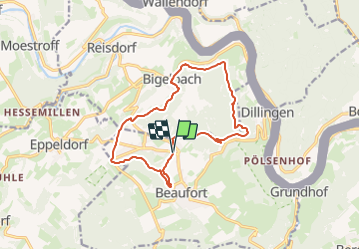
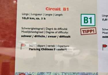
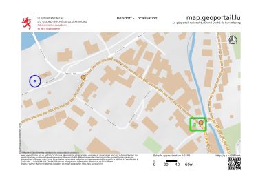
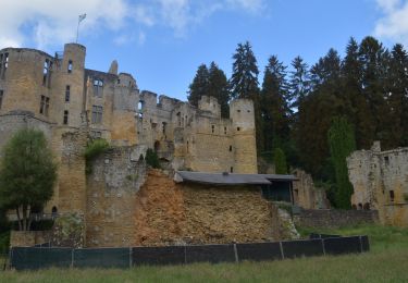
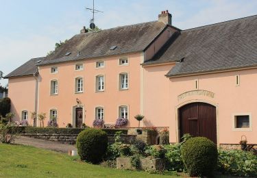
Trail Walking of 12.9 km to be discovered at Unknown, Canton Echternach, Beaufort. This trail is proposed by mumu.larandonneuse.
Description
📌 au centre de Beaufort ou directement du 🏕 Camping Park Beaufort.
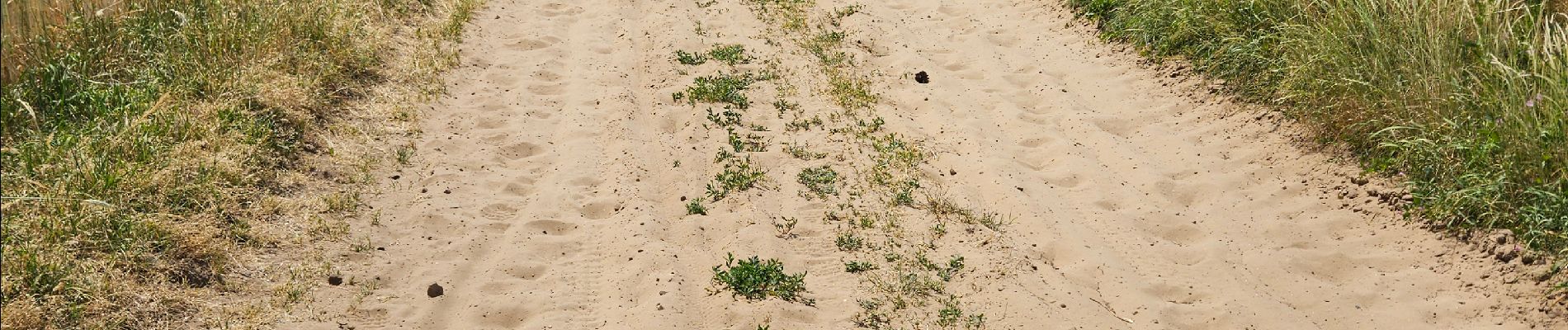
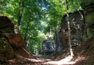
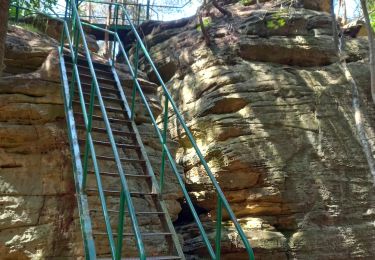
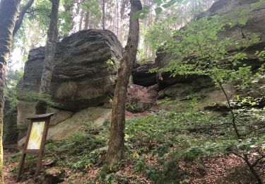
➡️ Beau parcours forestier avec quelques formations rocheuses et de belles vues sur les vallées de l'Our et la Sûre, traversant Bigelbach.
Positioning
Country:
Luxembourg
Region :
Unknown
Department/Province :
Canton Echternach
Municipality :
Beaufort
Location:
Unknown
Start:(Dec)
Start:(UTM)
304973 ; 5524798 (32U) N.
Comments
Trails nearby
![Trail Walking Berdorf - Berdorf - B2 - Müllerthal - Photo](https://media.geolcdn.com/t/375/260/ext.jpg?maxdim=2&url=https%3A%2F%2Fmedia.geolcdn.com%2Ff%2F517daf86-eb8b-412e-9a7e-d0a346807e81.jpg)
![Walking Walking](https://static1.geolcdn.com/sitytour/trail-icons/101.png)
Berdorf - B2 - Müllerthal
Walking
Medium
(1)
Berdorf,
Unknown,
Canton Echternach,
Luxembourg
![](/images/other/stat-length.png)
6.7 km | 8.5 km-effort
1h 35min
![](https://static1.geolcdn.com/siteimages/upload/files/16400158638029165_repeat_loop_refresh_sync_direction_icon.png)
Yes
![Trail Walking Beaufort - 2021-07-05_20h10m00_gpx-file (1) - Photo](https://media.geolcdn.com/t/375/260/ext.jpg?maxdim=2&url=https%3A%2F%2Fmedia.geolcdn.com%2Ff%2F9b40ebf8-55f0-408d-8504-76ef1490c879.jpg)
![Walking Walking](https://static1.geolcdn.com/sitytour/trail-icons/101.png)
2021-07-05_20h10m00_gpx-file (1)
Walking
Medium
(1)
Beaufort,
Unknown,
Canton Echternach,
Luxembourg
![](/images/other/stat-length.png)
10.6 km | 13.6 km-effort
3h 5min
![](https://static1.geolcdn.com/siteimages/upload/files/16400158638029165_repeat_loop_refresh_sync_direction_icon.png)
Yes
![Trail Walking Reisdorf - R2 - Photo](https://media.geolcdn.com/t/375/260/ext.jpg?maxdim=2&url=https%3A%2F%2Fmedia.geolcdn.com%2Ff%2F7552b052-379e-4866-b586-5f7ed6a8b465.jpeg)
![Walking Walking](https://static1.geolcdn.com/sitytour/trail-icons/101.png)
![Trail Walking Berdorf - 2023-06-03_18h17m36_Sentier_local_-_B8 - Photo](https://media.geolcdn.com/t/375/260/ext.jpg?maxdim=2&url=https%3A%2F%2Fmedia.geolcdn.com%2Ff%2F7a8870ac-d558-4a39-b7c2-bdeb26e936c0.jpg)
![Walking Walking](https://static1.geolcdn.com/sitytour/trail-icons/101.png)
2023-06-03_18h17m36_Sentier_local_-_B8
Walking
Medium
(1)
Berdorf,
Unknown,
Canton Echternach,
Luxembourg
![](/images/other/stat-length.png)
11.7 km | 15 km-effort
3h 24min
![](https://static1.geolcdn.com/siteimages/upload/files/16400158638029165_repeat_loop_refresh_sync_direction_icon.png)
Yes
![Trail Walking Beaufort - Itinérant Luxembourg Jour 5 Beaufort - Vianden - Photo](https://media.geolcdn.com/t/375/260/ext.jpg?maxdim=2&url=https%3A%2F%2Fmedia.geolcdn.com%2Ff%2Fff07c1bf-829e-449b-b3de-c6b12513c684.jpg)
![Walking Walking](https://static1.geolcdn.com/sitytour/trail-icons/101.png)
Itinérant Luxembourg Jour 5 Beaufort - Vianden
Walking
Very difficult
Beaufort,
Unknown,
Canton Echternach,
Luxembourg
![](/images/other/stat-length.png)
30 km | 41 km-effort
6h 58min
![](https://static1.geolcdn.com/siteimages/upload/files/16400158638029165_repeat_loop_refresh_sync_direction_icon.png)
No
![Trail Walking Beaufort - Muller 1 - Photo](https://media.geolcdn.com/t/375/260/ext.jpg?maxdim=2&url=https%3A%2F%2Fmedia.geolcdn.com%2Ff%2Fe7bc25ac-f60c-4b61-8fb0-28c4c8f4aaca.JPG)
![Walking Walking](https://static1.geolcdn.com/sitytour/trail-icons/101.png)
Muller 1
Walking
Medium
Beaufort,
Unknown,
Canton Echternach,
Luxembourg
![](/images/other/stat-length.png)
12 km | 15.6 km-effort
3h 0min
![](https://static1.geolcdn.com/siteimages/upload/files/16400158638029165_repeat_loop_refresh_sync_direction_icon.png)
No
![Trail Walking Beaufort - 20220524 - Beaufort 11.3 Km - Photo](https://media.geolcdn.com/t/375/260/ext.jpg?maxdim=2&url=https%3A%2F%2Fmedia.geolcdn.com%2Ff%2F7f15aa23-16da-493d-af53-ef5bf9ff895e.JPG)
![Walking Walking](https://static1.geolcdn.com/sitytour/trail-icons/101.png)
20220524 - Beaufort 11.3 Km
Walking
Difficult
Beaufort,
Unknown,
Canton Echternach,
Luxembourg
![](/images/other/stat-length.png)
11.3 km | 14.4 km-effort
4h 27min
![](https://static1.geolcdn.com/siteimages/upload/files/16400158638029165_repeat_loop_refresh_sync_direction_icon.png)
Yes
![Trail On foot Waldbillig - W1 Hiking Tour - Photo](https://media.geolcdn.com/t/375/260/ext.jpg?maxdim=2&url=https%3A%2F%2Fmedia.geolcdn.com%2Ff%2Fb0d3cca2-c926-40ca-a809-02e296f403e6.jpeg)
![On foot On foot](https://static1.geolcdn.com/sitytour/trail-icons/100.png)
W1 Hiking Tour
On foot
Easy
Waldbillig,
Unknown,
Canton Echternach,
Luxembourg
![](/images/other/stat-length.png)
6.8 km | 8.4 km-effort
1h 54min
![](https://static1.geolcdn.com/siteimages/upload/files/16400158638029165_repeat_loop_refresh_sync_direction_icon.png)
Yes
![Trail On foot Waldbillig - W5 Hiking Tour - Photo](https://media.geolcdn.com/t/375/260/ext.jpg?maxdim=2&url=https%3A%2F%2Fmedia.geolcdn.com%2Ff%2Fb005563f-bb5b-40b3-abae-5a4b2fd000ce.jpeg)
![On foot On foot](https://static1.geolcdn.com/sitytour/trail-icons/100.png)
W5 Hiking Tour
On foot
Easy
Waldbillig,
Unknown,
Canton Echternach,
Luxembourg
![](/images/other/stat-length.png)
10.2 km | 13.7 km-effort
3h 6min
![](https://static1.geolcdn.com/siteimages/upload/files/16400158638029165_repeat_loop_refresh_sync_direction_icon.png)
Yes
Superbe ballade. Merci.
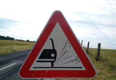
Superbe parcours forestier 🌳🌲 sans difficultés.