


Le collet vert

Klhn
User

Length
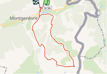
9.5 km

Max alt
2413 m

Uphill gradient
600 m
Km-Effort
17.5 km

Min alt
1843 m

Downhill gradient
594 m
Boucle
Yes
Creation date :
2021-07-06 08:12:48.0
Updated on :
2021-07-06 12:20:11.926
3h05
Difficulty : Difficult

FREE GPS app for hiking
 SityTrail
IGN / Geographical institutes
SityTrail Plus
The world is yours!
About
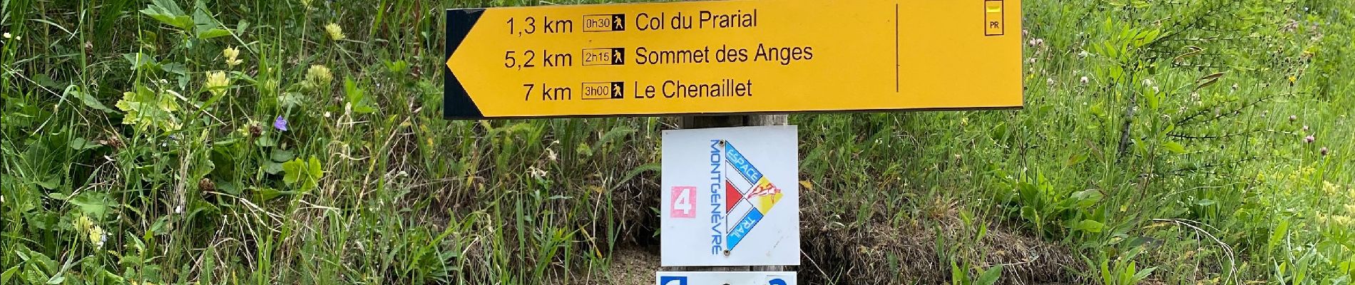
Trail Walking of 9.5 km to be discovered at Provence-Alpes-Côte d'Azur, Hautes-Alpes, Montgenèvre. This trail is proposed by Klhn.
Photos


Positioning
Country:
France
Region :
Provence-Alpes-Côte d'Azur
Department/Province :
Hautes-Alpes
Municipality :
Montgenèvre
Location:
Unknown
Start:(Dec)
Start:(UTM)
320837 ; 4978109 (32T) N.
Comments