


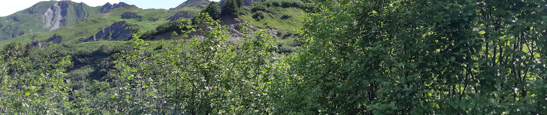
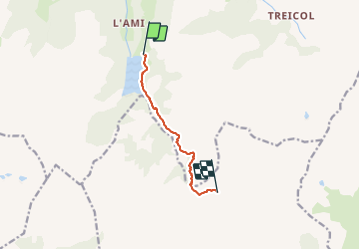
REFUGE DE LA COIRE DEPUIS LE LAC DE SAINT GUERIN

walrou63
User

Length
6.2 km

Max alt
2109 m

Uphill gradient
566 m
Km-Effort
12.1 km

Min alt
1551 m

Downhill gradient
81 m
Boucle
No
Creation date :
2021-07-06 07:04:09.454
Updated on :
2021-07-06 15:10:06.182
2h39
Difficulty : Difficult

FREE GPS app for hiking
 SityTrail
IGN / Geographical institutes
SityTrail Plus
The world is yours!
About
Trail Walking of 6.2 km to be discovered at Auvergne-Rhône-Alpes, Savoy, Beaufort. This trail is proposed by walrou63.
Photos


Positioning
Country:
France
Region :
Auvergne-Rhône-Alpes
Department/Province :
Savoy
Municipality :
Beaufort
Location:
Unknown
Start:(Dec)
Start:(UTM)
311691 ; 5058093 (32T) N.
Comments