


GR10U2

LouisROGER
User GUIDE
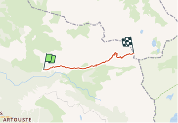

Length
6.7 km

Max alt
2456 m

Uphill gradient
907 m
Km-Effort
15.9 km

Min alt
1579 m

Downhill gradient
62 m
Boucle
No
Creation date :
2021-07-10 06:53:01.384
Updated on :
2021-07-12 15:54:14.571
6h51
Difficulty : Very difficult

FREE GPS app for hiking
 SityTrail
IGN / Geographical institutes
SityTrail Plus
The world is yours!
About
Trail Walking of 6.7 km to be discovered at New Aquitaine, Pyrénées-Atlantiques, Laruns. This trail is proposed by LouisROGER.
Description
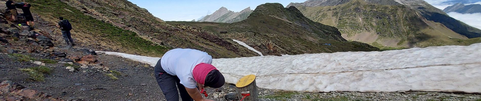
portion de GR10 U balisée le samedi 10 juilllet
Photos


Positioning
Country:
France
Region :
New Aquitaine
Department/Province :
Pyrénées-Atlantiques
Municipality :
Laruns
Location:
Unknown
Start:(Dec)
Start:(UTM)
712775 ; 4754311 (30T) N.
Comments