


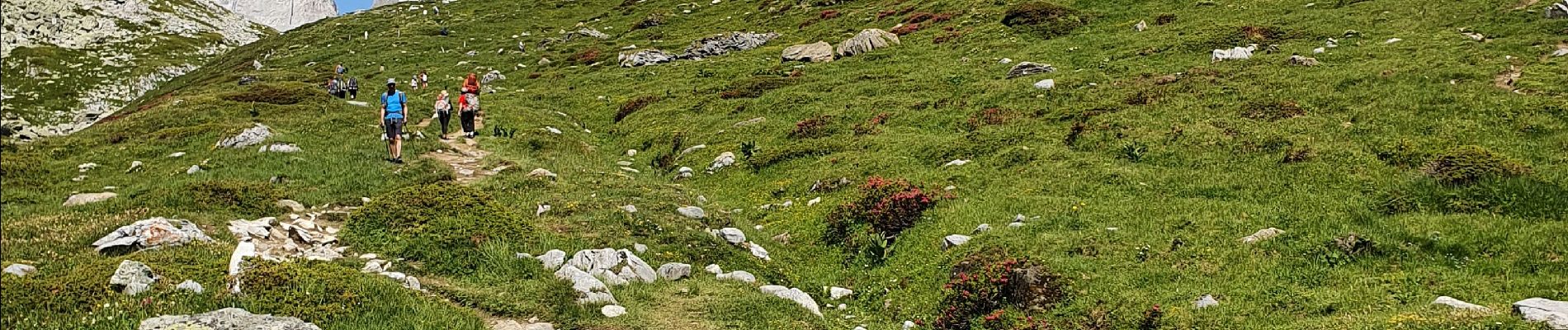
refuge de la Vanoise

amiral13
User GUIDE
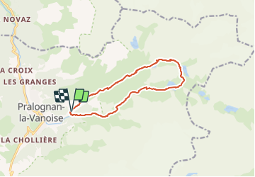

Length
12.6 km

Max alt
2517 m

Uphill gradient
868 m
Km-Effort
24 km

Min alt
1648 m

Downhill gradient
862 m
Boucle
Yes
Creation date :
2021-07-11 07:52:38.874
Updated on :
2021-07-12 16:53:45.989
6h16
Difficulty : Medium

FREE GPS app for hiking
 SityTrail
IGN / Geographical institutes
SityTrail Plus
The world is yours!
About
Trail Walking of 12.6 km to be discovered at Auvergne-Rhône-Alpes, Savoy, Pralognan-la-Vanoise. This trail is proposed by amiral13.
Photos


Positioning
Country:
France
Region :
Auvergne-Rhône-Alpes
Department/Province :
Savoy
Municipality :
Pralognan-la-Vanoise
Location:
Unknown
Start:(Dec)
Start:(UTM)
322771 ; 5027877 (32T) N.
Comments