


col croix de fer

verozerr
User

Length
2.1 km

Max alt
2121 m

Uphill gradient
14 m
Km-Effort
2.4 km

Min alt
2055 m

Downhill gradient
67 m
Boucle
No
Creation date :
2021-07-11 13:54:34.211
Updated on :
2021-07-12 06:22:04.651
1h05
Difficulty : Very easy

FREE GPS app for hiking
 SityTrail
IGN / Geographical institutes
SityTrail Plus
The world is yours!
About
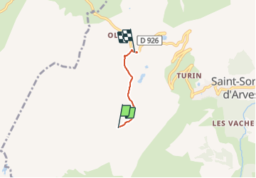
Trail Walking of 2.1 km to be discovered at Auvergne-Rhône-Alpes, Savoy, Saint-Sorlin-d'Arves. This trail is proposed by verozerr.
Description
colcroix de fer
Positioning
Country:
France
Region :
Auvergne-Rhône-Alpes
Department/Province :
Savoy
Municipality :
Saint-Sorlin-d'Arves
Location:
Unknown
Start:(Dec)
Start:(UTM)
280089 ; 5010611 (32T) N.
Comments