


Chabre aller +retour 705 +

claude nier
User
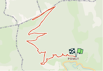

Length
19.2 km

Max alt
1335 m

Uphill gradient
705 m
Km-Effort
29 km

Min alt
652 m

Downhill gradient
705 m
Boucle
Yes
Creation date :
2021-07-13 13:27:29.87
Updated on :
2021-07-13 13:28:44.351
6h29
Difficulty : Medium

FREE GPS app for hiking
 SityTrail
IGN / Geographical institutes
SityTrail Plus
The world is yours!
About
Trail On foot of 19.2 km to be discovered at Provence-Alpes-Côte d'Azur, Hautes-Alpes, Val-Buëch-Méouge. This trail is proposed by claude nier.
Description
aller et retour par la route
trop bonnnnnnnnnnnnnnn...
Positioning
Country:
France
Region :
Provence-Alpes-Côte d'Azur
Department/Province :
Hautes-Alpes
Municipality :
Val-Buëch-Méouge
Location:
Châteauneuf-de-Chabre
Start:(Dec)
Start:(UTM)
722602 ; 4906913 (31T) N.
Comments