


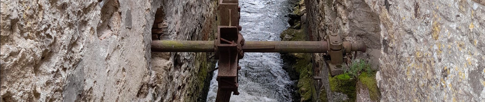
DEUX SEVRES / AIRVAULT: LES ANCIENS MOULINS

djeepee74
User


5h15
Difficulty : Medium

FREE GPS app for hiking
 SityTrail
IGN / Geographical institutes
SityTrail Plus
The world is yours!
About
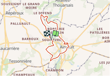
Trail Walking of 13.8 km to be discovered at New Aquitaine, Deux-Sèvres, Airvault. This trail is proposed by djeepee74.
Description
BOUCLE... live 20210714
Entre Roche-Taillé et le Moulin de Salin, le circuit balisé jaune suit le tracé rose de la carte topo IGN... Ne longer le thouet que vêtu d'un pantalon (les bords de la rivière ne sont pas entretenus et les herbes peuvent être très hautes).
A la sortie d'Airvault, après les pompiers, rester sur le bord gauche de la route ... mais sans emprunter le sentier "réservé aux piétons", lequel vous mène dans un lotissement !
Photos


Positioning
Comments