


banyuls

dbenoit
User
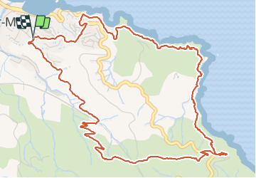

Length
8.2 km

Max alt
200 m

Uphill gradient
262 m
Km-Effort
11.7 km

Min alt
7 m

Downhill gradient
255 m
Boucle
Yes
Creation date :
2021-07-16 08:08:05.852
Updated on :
2021-07-16 13:48:55.197
3h25
Difficulty : Medium

FREE GPS app for hiking
 SityTrail
IGN / Geographical institutes
SityTrail Plus
The world is yours!
About
Trail Walking of 8.2 km to be discovered at Occitania, Pyrénées-Orientales, Banyuls-sur-Mer. This trail is proposed by dbenoit.
Positioning
Country:
France
Region :
Occitania
Department/Province :
Pyrénées-Orientales
Municipality :
Banyuls-sur-Mer
Location:
Unknown
Start:(Dec)
Start:(UTM)
511015 ; 4702851 (31T) N.
Comments