Trail Motorbike Sarrebourg - export-route-des-cretes-cols-vosgiens - Photo

export-route-des-cretes-cols-vosgiens

 HG74250
HG74250

User

© OpenStreetMap contributors
Length
Length
449 km
Max alt
Max alt
1339 m
Uphill gradient
Uphill gradient
9152 m
Km-Effort
Km-Effort  
571 km
Min alt
Min alt
228 m
Downhill gradient
Downhill gradient
9187 m
Boucle
Boucle
No
Creation date :
2021-07-17 09:18:18.529
Updated on :
2021-07-17 09:21:59.534

(0 Reviews)

Motorbike
Motorbike
--
Difficulty : Very easy

Scan this QR Code to open this trail in the SityTrail application

FREE GPS app for hiking

Logo SityTrail SityTrail

IGN / Geographical institutes

Download SityTrail from the App Store Download SityTrail from Google Play

Logo SityTrail SityTrail World

The world is yours!

Download SityTrail from the App Store Download SityTrail from Google Play Download SityTrail on Huawei AppGallery

About

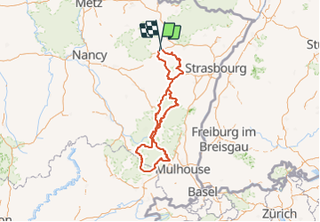
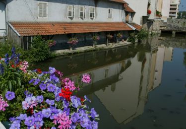
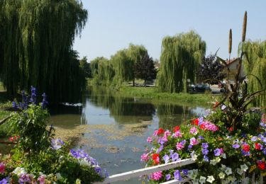
Trail Motorbike of 449 km to be discovered at Grand Est, Moselle, Sarrebourg. This trail is proposed by HG74250.

Description

Départ de Sarrebourg pour une ballade jusqu'au au sud des vosges par la route des crêtes et retour par de nombreux cols et petites routes de moyenne montagne.
Cette balade moto de 451.02 km s'effectue en 08h15 environ.
Elle traverse les régions : Grand Est, Bourgogne Franche-Comté et les départements : Moselle, Bas-Rhin, Haut-Rhin, Vosges, Territoire de Belfort.

Elevation profile

Positioning

Country:
France
Region :
Grand Est
Department/Province :
Moselle
Municipality :
Sarrebourg
Location:
Unknown
Start:(UTM)
356380 ; 5398126 (32U) N.

Trails nearby

Trail Cycle Sarrebourg - Aux portes de Sarrebourg, le Pays des Grands Etangs - Sarrebourg - Circuit 20 - Photo
Cycle
tracegps

Cycle

Difficult
Sarrebourg, Grand Est, Moselle, France
59 km | 69 km-effort
3h 30min
Yes
Trail Walking Dolving - 2022-05-25-Circuit St Ulrich - Photo
Walking
milou1941

Walking

Easy
Dolving, Grand Est, Moselle, France
4.8 km | 5.9 km-effort
1h 20min
Yes
Trail Mountain bike Sarrebourg - Circuit VTT de Réding-Sarrebourg - Photo
Mountain bike
tracegps

Mountain bike

Difficult
Sarrebourg, Grand Est, Moselle, France
35 km | 42 km-effort
4h 0min
Yes
Trail Mountain bike Sarrebourg - Circuit VTT des Etangs de Rinting - Photo
Mountain bike
tracegps

Mountain bike

Difficult
Sarrebourg, Grand Est, Moselle, France
26 km | 31 km-effort
2h 30min
Yes
Trail Mountain bike Sarrebourg - Circuit VTT de la Vallée de la Sarre -Sarrebourg - Photo
Mountain bike
tracegps

Mountain bike

Medium
(1)
Sarrebourg, Grand Est, Moselle, France
18.9 km | 23 km-effort
1h 30min
Yes
Trail Mountain bike Sarrebourg - Circuit VTT de la Zone de Loisirs - Sarrebourg - Photo
Mountain bike
tracegps

Mountain bike

Easy
Sarrebourg, Grand Est, Moselle, France
4.6 km | 5.3 km-effort
30min
Yes
Trail Horseback riding Niderviller - Forêt reding - Photo
Horseback riding
Déborah Pagès

Horseback riding

Easy
Niderviller, Grand Est, Moselle, France
5.4 km | 6.6 km-effort
55min
No
Trail Mountain bike Bébing - Bebing-Walscheid-Mont Ste Odile en VTT - Photo
Mountain bike
bbazin

Mountain bike

Difficult
Bébing, Grand Est, Moselle, France
72 km | 97 km-effort
6h 40min
No
Trail Bicycle tourism Hesse - Boucle Hesse - Abreschviller - Sarrebourg - Photo
Bicycle tourism
nfranche

Bicycle tourism

Medium
Hesse, Grand Est, Moselle, France
49 km | 56 km-effort
Unknown
Yes


Close
My subscriptions