


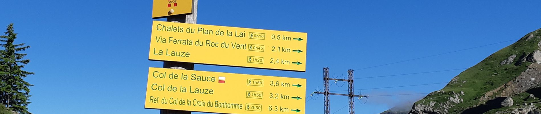
COL DE LA SAUCE

walrou63
User
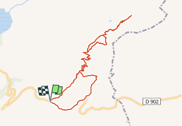

Length
11.5 km

Max alt
2322 m

Uphill gradient
548 m
Km-Effort
18.8 km

Min alt
1811 m

Downhill gradient
542 m
Boucle
Yes
Creation date :
2021-07-17 06:46:14.787
Updated on :
2021-07-30 09:08:58.291
3h30
Difficulty : Difficult

FREE GPS app for hiking
 SityTrail
IGN / Geographical institutes
SityTrail Plus
The world is yours!
About
Trail Walking of 11.5 km to be discovered at Auvergne-Rhône-Alpes, Savoy, Beaufort. This trail is proposed by walrou63.
Photos


31 photos in total. Please click on a photo to see them all in the gallery.
Positioning
Country:
France
Region :
Auvergne-Rhône-Alpes
Department/Province :
Savoy
Municipality :
Beaufort
Location:
Unknown
Start:(Dec)
Start:(UTM)
318586 ; 5062586 (32T) N.
Comments