


Fréland - Blancrupt

duchaine.nicolas
User
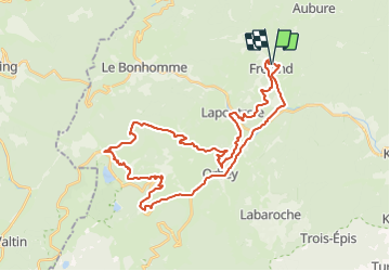

Length
39 km

Max alt
1189 m

Uphill gradient
1244 m
Km-Effort
55 km

Min alt
357 m

Downhill gradient
1239 m
Boucle
Yes
Creation date :
2021-07-17 13:45:36.696
Updated on :
2021-07-18 07:48:19.546
4h15
Difficulty : Easy
4h15
Difficulty : Easy

FREE GPS app for hiking
 SityTrail
IGN / Geographical institutes
SityTrail Plus
The world is yours!
About
Trail Mountain bike of 39 km to be discovered at Grand Est, Haut-Rhin, Fréland. This trail is proposed by duchaine.nicolas.
Description
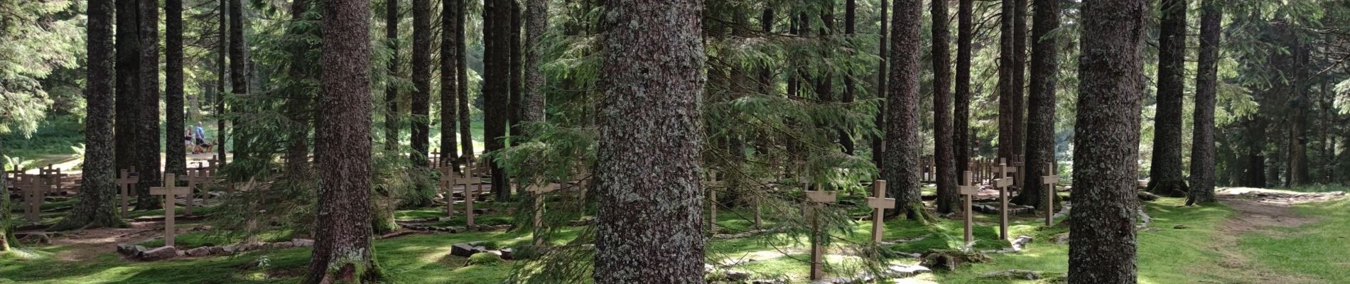
Via Lapoutroie, Col de Bermont, Surcenord, Cimetière Duchesne
Retour Bocheney, Roche du Pin, La Chaume, Les Machielles, Pairis, Orbey
Photos

Positioning
Country:
France
Region :
Grand Est
Department/Province :
Haut-Rhin
Municipality :
Fréland
Location:
Unknown
Start:(Dec)
Start:(UTM)
365797 ; 5337177 (32U) N.
Comments