


Refuge Nivolet VALLEE AOSTE

lepi
User
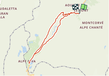

Length
17.4 km

Max alt
2545 m

Uphill gradient
695 m
Km-Effort
27 km

Min alt
1957 m

Downhill gradient
689 m
Boucle
Yes
Creation date :
2021-07-18 08:16:53.916
Updated on :
2021-07-18 17:42:51.416
8h51
Difficulty : Very difficult

FREE GPS app for hiking
 SityTrail
IGN / Geographical institutes
SityTrail Plus
The world is yours!
About
Trail Walking of 17.4 km to be discovered at Aosta Valley, Unknown, Valsavarenche. This trail is proposed by lepi.
Positioning
Country:
Italy
Region :
Aosta Valley
Department/Province :
Unknown
Municipality :
Valsavarenche
Location:
Unknown
Start:(Dec)
Start:(UTM)
359511 ; 5042798 (32T) N.
Comments