


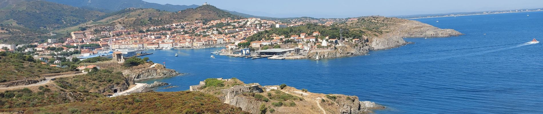
20210719 Port Vendres

Childebert
User
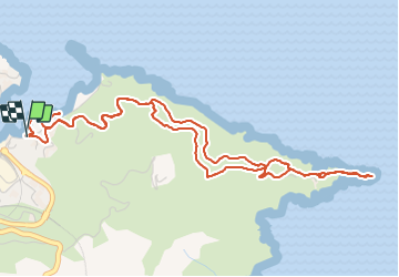

Length
7 km

Max alt
112 m

Uphill gradient
189 m
Km-Effort
9.5 km

Min alt
4 m

Downhill gradient
188 m
Boucle
Yes
Creation date :
2021-07-19 09:26:21.607
Updated on :
2021-07-19 18:54:12.822
3h39
Difficulty : Medium

FREE GPS app for hiking
 SityTrail
IGN / Geographical institutes
SityTrail Plus
The world is yours!
About
Trail Walking of 7 km to be discovered at Occitania, Pyrénées-Orientales, Port-Vendres. This trail is proposed by Childebert.
Photos

Positioning
Country:
France
Region :
Occitania
Department/Province :
Pyrénées-Orientales
Municipality :
Port-Vendres
Location:
Unknown
Start:(Dec)
Start:(UTM)
509360 ; 4707278 (31T) N.
Comments