


Les Arcs

PhilPerfect
User

Length
39 km

Max alt
2168 m

Uphill gradient
954 m
Km-Effort
55 km

Min alt
643 m

Downhill gradient
1749 m
Boucle
No
Creation date :
2021-07-19 10:38:20.204
Updated on :
2021-07-20 09:20:35.725
22h35
Difficulty : Medium

FREE GPS app for hiking
 SityTrail
IGN / Geographical institutes
SityTrail Plus
The world is yours!
About
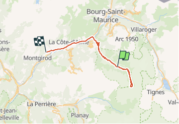
Trail Walking of 39 km to be discovered at Auvergne-Rhône-Alpes, Savoy, Peisey-Nancroix. This trail is proposed by PhilPerfect.
Positioning
Country:
France
Region :
Auvergne-Rhône-Alpes
Department/Province :
Savoy
Municipality :
Peisey-Nancroix
Location:
Unknown
Start:(Dec)
Start:(UTM)
328384 ; 5042952 (32T) N.
Comments