


Testa del Ruitor

mpignon
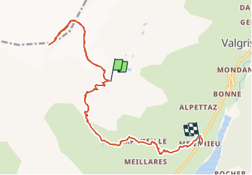
User

Length
10.2 km

Max alt
3451 m

Uphill gradient
548 m
Km-Effort
21 km

Min alt
1866 m

Downhill gradient
1583 m
Boucle
No
Creation date :
2021-07-22 04:16:45.903
Updated on :
2021-07-23 08:28:29.195
6h33
Difficulty : Difficult

FREE GPS app for hiking
 SityTrail
IGN / Geographical institutes
SityTrail Plus
The world is yours!
About
Trail Other activity of 10.2 km to be discovered at Aosta Valley, Unknown, Valgrisenche. This trail is proposed by mpignon.
Positioning
Country:
Italy
Region :
Aosta Valley
Department/Province :
Unknown
Municipality :
Valgrisenche
Location:
Unknown
Start:(Dec)
Start:(UTM)
346419 ; 5054214 (32T) N.
Comments