


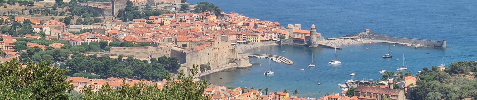
Rando Port Vendres du 23/07/2021

dudu79
User
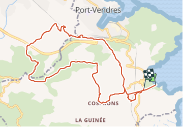

Length
12.9 km

Max alt
257 m

Uphill gradient
381 m
Km-Effort
18 km

Min alt
2 m

Downhill gradient
387 m
Boucle
No
Creation date :
2021-07-23 07:48:55.466
Updated on :
2021-07-23 12:48:48.48
3h09
Difficulty : Difficult

FREE GPS app for hiking
 SityTrail
IGN / Geographical institutes
SityTrail Plus
The world is yours!
About
Trail Walking of 12.9 km to be discovered at Occitania, Pyrénées-Orientales, Port-Vendres. This trail is proposed by dudu79.
Photos


Positioning
Country:
France
Region :
Occitania
Department/Province :
Pyrénées-Orientales
Municipality :
Port-Vendres
Location:
Unknown
Start:(Dec)
Start:(UTM)
509946 ; 4705387 (31T) N.
Comments