


fort partecreuse

lionel4806
User
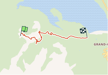

Length
5.4 km

Max alt
2392 m

Uphill gradient
31 m
Km-Effort
7.2 km

Min alt
1974 m

Downhill gradient
438 m
Boucle
No
Creation date :
2021-07-26 17:26:50.342
Updated on :
2021-07-28 06:46:53.383
1h16
Difficulty : Medium

FREE GPS app for hiking
 SityTrail
IGN / Geographical institutes
SityTrail Plus
The world is yours!
About
Trail Walking of 5.4 km to be discovered at Auvergne-Rhône-Alpes, Savoy, Val-Cenis. This trail is proposed by lionel4806.
Description
eando
Positioning
Country:
France
Region :
Auvergne-Rhône-Alpes
Department/Province :
Savoy
Municipality :
Val-Cenis
Location:
Lanslebourg-Mont-Cenis
Start:(Dec)
Start:(UTM)
335640 ; 5009897 (32T) N.
Comments