


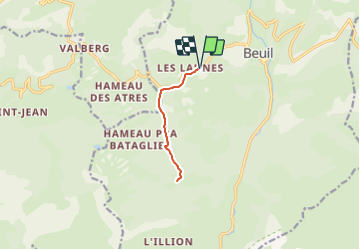
BEUIL 8KM

jpb83
User

Length
8.3 km

Max alt
1592 m

Uphill gradient
195 m
Km-Effort
10.9 km

Min alt
1480 m

Downhill gradient
197 m
Boucle
Yes
Creation date :
2021-07-29 11:06:52.8
Updated on :
2021-07-29 11:06:55.07
50m
Difficulty : Easy

FREE GPS app for hiking
 SityTrail
IGN / Geographical institutes
SityTrail Plus
The world is yours!
About
Trail Running of 8.3 km to be discovered at Provence-Alpes-Côte d'Azur, Maritime Alps, Beuil. This trail is proposed by jpb83.
Positioning
Country:
France
Region :
Provence-Alpes-Côte d'Azur
Department/Province :
Maritime Alps
Municipality :
Beuil
Location:
Unknown
Start:(Dec)
Start:(UTM)
337510 ; 4883932 (32T) N.
Comments