Trail Walking Bidarray - col de mehatse - Photo
© OpenStreetMap contributors
Length
Length
17.7 km
Max alt
Max alt
750 m
Uphill gradient
Uphill gradient
843 m
Km-Effort
Km-Effort  
29 km
Min alt
Min alt
80 m
Downhill gradient
Downhill gradient
838 m
Boucle
Boucle
Yes
Creation date :
2021-07-29 08:26:40.807
Updated on :
2021-07-29 15:33:24.147

(0 Reviews)

Walking
Walking
4h32
Difficulty : Easy

Scan this QR Code to open this trail in the SityTrail application

FREE GPS app for hiking

Logo SityTrail SityTrail

IGN / Geographical institutes

Download SityTrail from the App Store Download SityTrail from Google Play

Logo SityTrail SityTrail Plus

The world is yours!

Download SityTrail from the App Store Download SityTrail from Google Play Download SityTrail on Huawei AppGallery

About

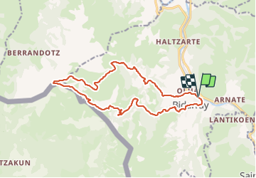
Trail Walking of 17.7 km to be discovered at New Aquitaine, Pyrénées-Atlantiques, Bidarray. This trail is proposed by gamille67.

Description

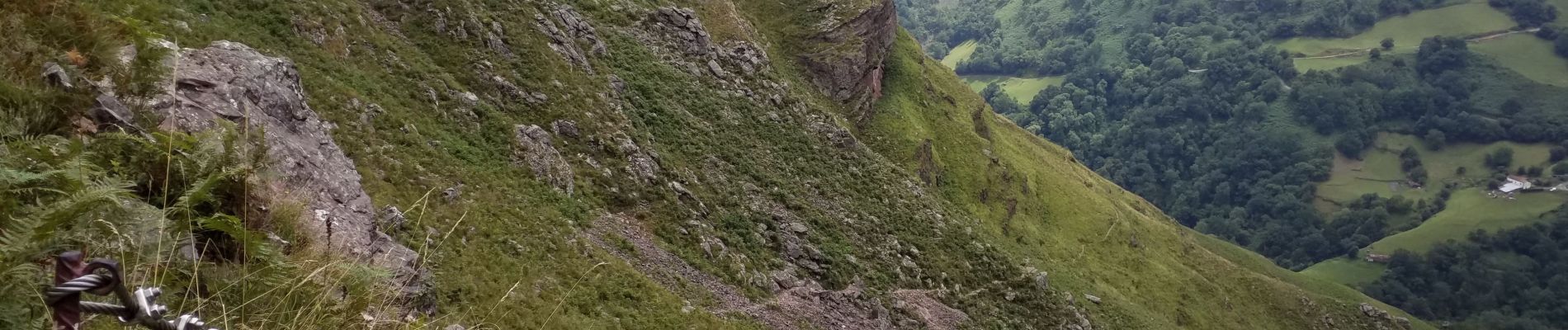
Petite montée d'adrénaline dans la descente du col de Mehatse vers Bidarray via le GR10 : des vautours tournent au dessus de nous et le cadavre d'une chèvre se décompose dans le ravin. La descente est raide et technique, avec quelques mains courantes...

Elevation profile

Photos

Positioning

Country:
France
Region :
New Aquitaine
Department/Province :
Pyrénées-Atlantiques
Municipality :
Bidarray
Location:
Unknown
Start:(UTM)
634197 ; 4791954 (30T) N.


Close
My subscriptions