


G-WybBiM0MM

norbertmarteau
User
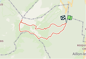

Length
7.6 km

Max alt
1852 m

Uphill gradient
515 m
Km-Effort
14.5 km

Min alt
1339 m

Downhill gradient
514 m
Boucle
Yes
Creation date :
2021-07-29 17:24:20.506
Updated on :
2021-07-29 17:35:35.631
3h17
Difficulty : Difficult

FREE GPS app for hiking
 SityTrail
IGN / Geographical institutes
SityTrail Plus
The world is yours!
About
Trail Walking of 7.6 km to be discovered at Auvergne-Rhône-Alpes, Savoy, Aillon-le-Jeune. This trail is proposed by norbertmarteau.
Points of interest


Positioning
Country:
France
Region :
Auvergne-Rhône-Alpes
Department/Province :
Savoy
Municipality :
Aillon-le-Jeune
Location:
Unknown
Start:(Dec)
Start:(UTM)
271437 ; 5057667 (32T) N.
Comments