Trail Walking Bidarray - GR 10 - 4ème étape : Bidarray - St Etienne de Baigorryg - Photo

GR 10 - 4ème étape : Bidarray - St Etienne de Baigorryg

 LEGUE
LEGUE

User

© OpenStreetMap contributors
Length
Length
18.1 km
Max alt
Max alt
1036 m
Uphill gradient
Uphill gradient
1233 m
Km-Effort
Km-Effort  
34 km
Min alt
Min alt
138 m
Downhill gradient
Downhill gradient
1218 m
Boucle
Boucle
No
Creation date :
2021-08-05 05:17:52.0
Updated on :
2021-08-05 11:39:57.563

(0 Reviews)

Walking
Walking
4h58
Difficulty : Very difficult

Scan this QR Code to open this trail in the SityTrail application

FREE GPS app for hiking

Logo SityTrail SityTrail

IGN / Geographical institutes

Download SityTrail from the App Store Download SityTrail from Google Play

Logo SityTrail SityTrail Plus

The world is yours!

Download SityTrail from the App Store Download SityTrail from Google Play Download SityTrail on Huawei AppGallery

About

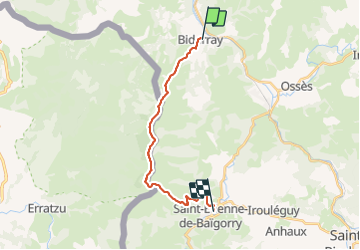
Trail Walking of 18.1 km to be discovered at New Aquitaine, Pyrénées-Atlantiques, Bidarray. This trail is proposed by LEGUE.

Description

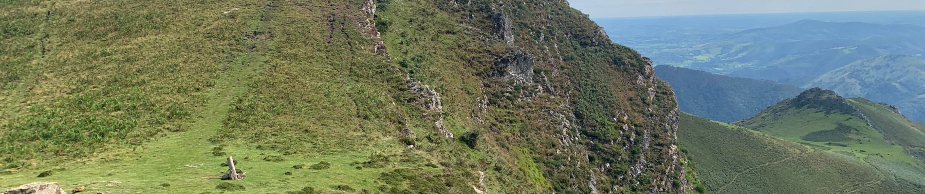
Grosse étape, très physique et pourtant que 18km
Mais le premier dénivelé positif en sortant de Bidarray fait environ 900 m dans les cailloux avec des « marches » hautes …
Mais les paysages sont à couper le double toute la journée
Beau temps a légèrement couvert

Elevation profile

Photos

Positioning

Country:
France
Region :
New Aquitaine
Department/Province :
Pyrénées-Atlantiques
Municipality :
Bidarray
Location:
Unknown
Start:(UTM)
634015 ; 4791635 (30T) N.


Close
My subscriptions