


col du haut du four

laurentnecca
User
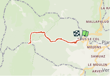

Length
8.3 km

Max alt
1620 m

Uphill gradient
791 m
Km-Effort
18.8 km

Min alt
826 m

Downhill gradient
793 m
Boucle
Yes
Creation date :
2021-08-07 06:40:55.067
Updated on :
2021-08-07 10:51:07.514
3h51
Difficulty : Medium

FREE GPS app for hiking
 SityTrail
IGN / Geographical institutes
SityTrail Plus
The world is yours!
About
Trail Walking of 8.3 km to be discovered at Auvergne-Rhône-Alpes, Savoy, Verrens-Arvey. This trail is proposed by laurentnecca.
Positioning
Country:
France
Region :
Auvergne-Rhône-Alpes
Department/Province :
Savoy
Municipality :
Verrens-Arvey
Location:
Unknown
Start:(Dec)
Start:(UTM)
289498 ; 5060493 (32T) N.
Comments