


Lac du Plan Vallon

jpb83
User

Length
13.9 km

Max alt
2321 m

Uphill gradient
865 m
Km-Effort
25 km

Min alt
1573 m

Downhill gradient
865 m
Boucle
Yes
Creation date :
2021-08-07 20:21:57.08
Updated on :
2021-08-07 20:24:30.932
5h47
Difficulty : Medium

FREE GPS app for hiking
 SityTrail
IGN / Geographical institutes
SityTrail Plus
The world is yours!
About
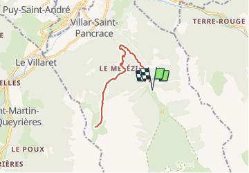
Trail Walking of 13.9 km to be discovered at Provence-Alpes-Côte d'Azur, Hautes-Alpes, Villar-Saint-Pancrace. This trail is proposed by jpb83.
Description
Un agréable parcours dans les mélèzes qui longe une partie d'un ancien canal d'irrigation et vous guide vers le lac du plan vallon dans son écrin minéral.
Positioning
Country:
France
Region :
Provence-Alpes-Côte d'Azur
Department/Province :
Hautes-Alpes
Municipality :
Villar-Saint-Pancrace
Location:
Unknown
Start:(Dec)
Start:(UTM)
314724 ; 4968945 (32T) N.
Comments