


Le Mailh Massibe et le Montagnon

chasle
User
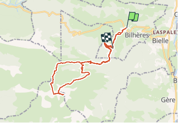

Length
22 km

Max alt
1950 m

Uphill gradient
1305 m
Km-Effort
39 km

Min alt
803 m

Downhill gradient
1159 m
Boucle
No
Creation date :
2021-08-09 03:49:29.377
Updated on :
2021-08-09 14:27:50.956
6h16
Difficulty : Very difficult

FREE GPS app for hiking
 SityTrail
IGN / Geographical institutes
SityTrail Plus
The world is yours!
About
Trail Walking of 22 km to be discovered at New Aquitaine, Pyrénées-Atlantiques, Bilhères. This trail is proposed by chasle.
Positioning
Country:
France
Region :
New Aquitaine
Department/Province :
Pyrénées-Atlantiques
Municipality :
Bilhères
Location:
Unknown
Start:(Dec)
Start:(UTM)
707164 ; 4770872 (30T) N.
Comments