


Têtes des Chaudières

ajd26
User
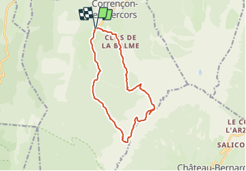

Length
14.4 km

Max alt
2048 m

Uphill gradient
1008 m
Km-Effort
28 km

Min alt
1143 m

Downhill gradient
1008 m
Boucle
Yes
Creation date :
2021-08-12 07:19:28.0
Updated on :
2021-08-13 13:08:56.16
5h21
Difficulty : Difficult

FREE GPS app for hiking
 SityTrail
IGN / Geographical institutes
SityTrail Plus
The world is yours!
About
Trail Walking of 14.4 km to be discovered at Auvergne-Rhône-Alpes, Isère, Corrençon-en-Vercors. This trail is proposed by ajd26.
Description
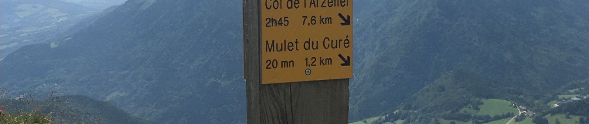
depart de Corrençon, pas de la Balme, tetes des Chaudières avec panoramas 360°
Photos


Positioning
Country:
France
Region :
Auvergne-Rhône-Alpes
Department/Province :
Isère
Municipality :
Corrençon-en-Vercors
Location:
Unknown
Start:(Dec)
Start:(UTM)
698350 ; 4988784 (31T) N.
Comments