


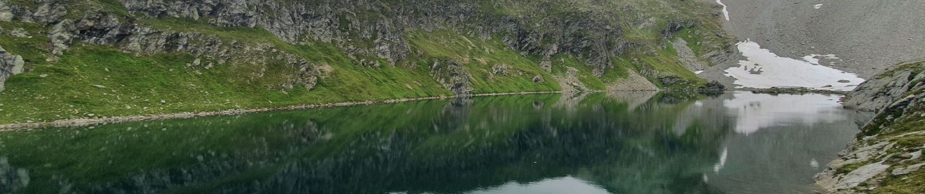
col de Monseti et lac Noir

amiral13
User GUIDE
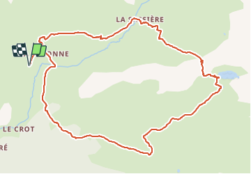

Length
12.9 km

Max alt
2530 m

Uphill gradient
839 m
Km-Effort
24 km

Min alt
1747 m

Downhill gradient
839 m
Boucle
Yes
Creation date :
2021-08-18 08:36:49.812
Updated on :
2021-08-18 21:21:55.657
5h42
Difficulty : Medium

FREE GPS app for hiking
 SityTrail
IGN / Geographical institutes
SityTrail Plus
The world is yours!
About
Trail Walking of 12.9 km to be discovered at Auvergne-Rhône-Alpes, Savoy, Sainte-Foy-Tarentaise. This trail is proposed by amiral13.
Photos


Positioning
Country:
France
Region :
Auvergne-Rhône-Alpes
Department/Province :
Savoy
Municipality :
Sainte-Foy-Tarentaise
Location:
Unknown
Start:(Dec)
Start:(UTM)
337623 ; 5053753 (32T) N.
Comments