


Boenlesgrab

ROPPJP
User
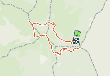

Length
7.2 km

Max alt
1266 m

Uphill gradient
355 m
Km-Effort
12.1 km

Min alt
880 m

Downhill gradient
400 m
Boucle
No
Creation date :
2021-08-20 07:01:15.52
Updated on :
2021-08-20 09:41:52.136
2h40
Difficulty : Difficult

FREE GPS app for hiking
 SityTrail
IGN / Geographical institutes
SityTrail Plus
The world is yours!
About
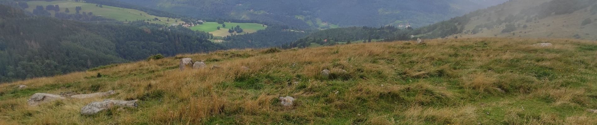
Trail Walking of 7.2 km to be discovered at Grand Est, Haut-Rhin, Wasserbourg. This trail is proposed by ROPPJP.
Description
manque début
Photos

Positioning
Country:
France
Region :
Grand Est
Department/Province :
Haut-Rhin
Municipality :
Wasserbourg
Location:
Unknown
Start:(Dec)
Start:(UTM)
361484 ; 5315641 (32T) N.
Comments