


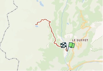
refuge et lac de l'Arpont

geoffrayLayeux
User

Length
14.5 km

Max alt
2690 m

Uphill gradient
1358 m
Km-Effort
33 km

Min alt
1347 m

Downhill gradient
1358 m
Boucle
Yes
Creation date :
2021-08-21 13:08:03.623
Updated on :
2021-08-21 13:08:39.212
7h25
Difficulty : Very difficult

FREE GPS app for hiking
 SityTrail
IGN / Geographical institutes
SityTrail Plus
The world is yours!
About
Trail Walking of 14.5 km to be discovered at Auvergne-Rhône-Alpes, Savoy, Val-Cenis. This trail is proposed by geoffrayLayeux.
Positioning
Country:
France
Region :
Auvergne-Rhône-Alpes
Department/Province :
Savoy
Municipality :
Val-Cenis
Location:
Termignon
Start:(Dec)
Start:(UTM)
328562 ; 5017945 (32T) N.
Comments