


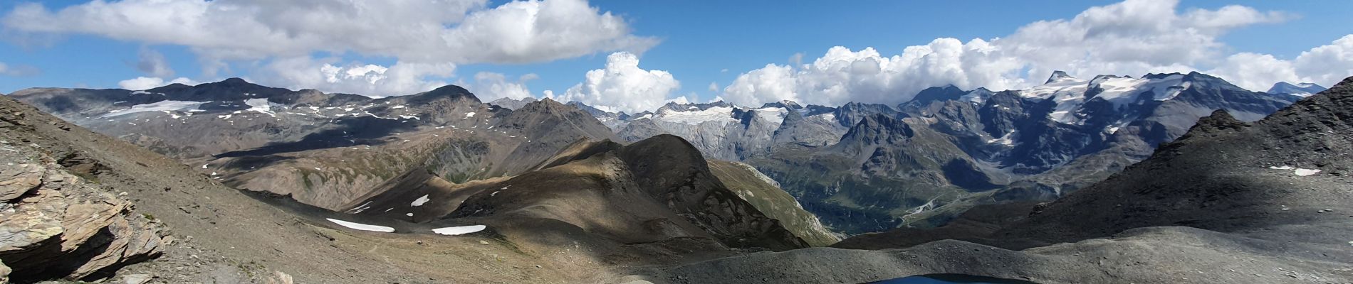
col et pointe des fours au départ du manchet

amiral13
User GUIDE
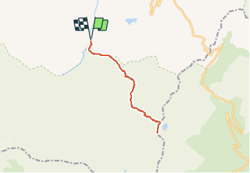

Length
13.5 km

Max alt
3046 m

Uphill gradient
1102 m
Km-Effort
28 km

Min alt
1942 m

Downhill gradient
1102 m
Boucle
Yes
Creation date :
2021-08-23 11:55:39.919
Updated on :
2021-08-23 18:03:03.083
3h43
Difficulty : Medium

FREE GPS app for hiking
 SityTrail
IGN / Geographical institutes
SityTrail Plus
The world is yours!
About
Trail Walking of 13.5 km to be discovered at Auvergne-Rhône-Alpes, Savoy, Val-d'Isère. This trail is proposed by amiral13.
Photos


Positioning
Country:
France
Region :
Auvergne-Rhône-Alpes
Department/Province :
Savoy
Municipality :
Val-d'Isère
Location:
Unknown
Start:(Dec)
Start:(UTM)
341386 ; 5031878 (32T) N.
Comments