


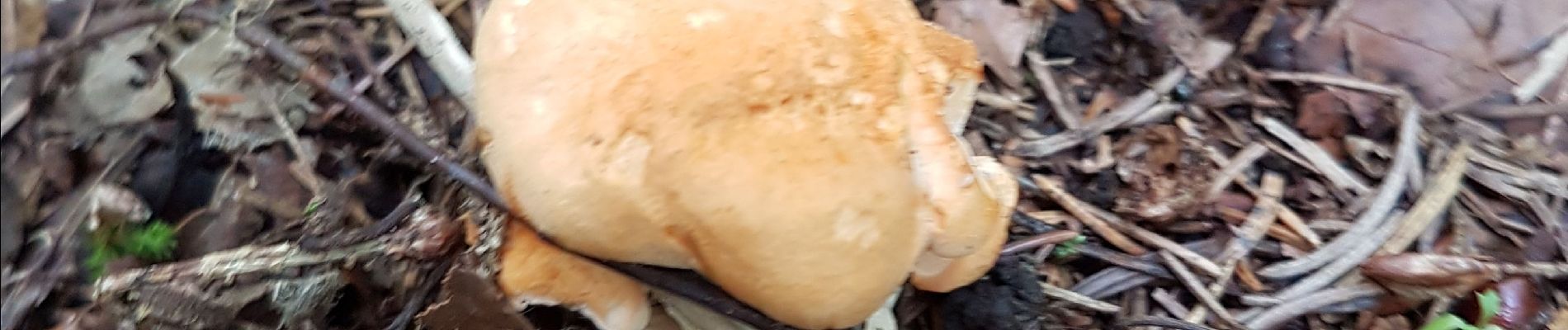
Pied de mouton

Bart2015
User
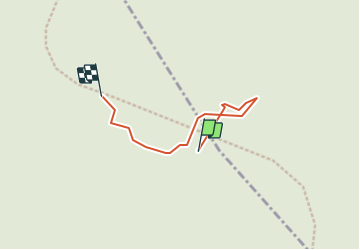

Length
63 m

Max alt
641 m

Uphill gradient
0 m
Km-Effort
63 m

Min alt
638 m

Downhill gradient
0 m
Boucle
No
Creation date :
2021-08-24 09:35:17.622
Updated on :
2021-08-24 09:38:30.37
3m
Difficulty : Very easy

FREE GPS app for hiking
 SityTrail
IGN / Geographical institutes
SityTrail Plus
The world is yours!
About
Trail Walking of 63 m to be discovered at Grand Est, Haut-Rhin, Dolleren. This trail is proposed by Bart2015.
Photos

Positioning
Country:
France
Region :
Grand Est
Department/Province :
Haut-Rhin
Municipality :
Dolleren
Location:
Unknown
Start:(Dec)
Start:(UTM)
345326 ; 5297435 (32T) N.
Comments