


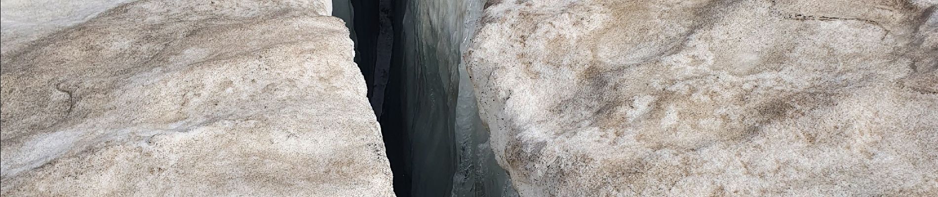
le glacier des sources de l'Isère

amiral13
User GUIDE
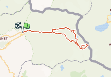

Length
17 km

Max alt
3114 m

Uphill gradient
1140 m
Km-Effort
32 km

Min alt
2063 m

Downhill gradient
1140 m
Boucle
Yes
Creation date :
2021-08-26 04:18:00.076
Updated on :
2021-08-26 18:12:28.429
10h49
Difficulty : Very difficult

FREE GPS app for hiking
 SityTrail
IGN / Geographical institutes
SityTrail Plus
The world is yours!
About
Trail Walking of 17 km to be discovered at Auvergne-Rhône-Alpes, Savoy, Val-d'Isère. This trail is proposed by amiral13.
Description
attention il s'agit d'une course d'alpinisme souvent hors sentiers utilisation du matériel pour le glacier
Photos


21 photos in total. Please click on a photo to see them all in the gallery.
Positioning
Country:
France
Region :
Auvergne-Rhône-Alpes
Department/Province :
Savoy
Municipality :
Val-d'Isère
Location:
Unknown
Start:(Dec)
Start:(UTM)
346594 ; 5035361 (32T) N.
Comments