


la sassiére

geoffrayLayeux
User

Length
13 km

Max alt
2879 m

Uphill gradient
657 m
Km-Effort
22 km

Min alt
2276 m

Downhill gradient
658 m
Boucle
Yes
Creation date :
2021-08-29 05:40:21.816
Updated on :
2021-08-29 05:40:23.574
4h56
Difficulty : Very difficult

FREE GPS app for hiking
 SityTrail
IGN / Geographical institutes
SityTrail Plus
The world is yours!
About
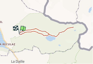
Trail Walking of 13 km to be discovered at Auvergne-Rhône-Alpes, Savoy, Tignes. This trail is proposed by geoffrayLayeux.
Positioning
Country:
France
Region :
Auvergne-Rhône-Alpes
Department/Province :
Savoy
Municipality :
Tignes
Location:
Unknown
Start:(Dec)
Start:(UTM)
341160 ; 5038946 (32T) N.
Comments