


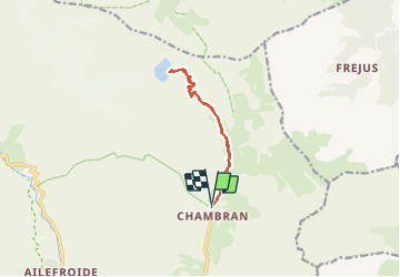
Lac de l’Eychauda

GOHIER
User

Length
11.9 km

Max alt
2519 m

Uphill gradient
824 m
Km-Effort
23 km

Min alt
1717 m

Downhill gradient
825 m
Boucle
Yes
Creation date :
2021-08-30 07:17:20.0
Updated on :
2021-08-30 13:46:06.255
6h26
Difficulty : Medium

FREE GPS app for hiking
 SityTrail
IGN / Geographical institutes
SityTrail Plus
The world is yours!
About
Trail Walking of 11.9 km to be discovered at Provence-Alpes-Côte d'Azur, Hautes-Alpes, Vallouise-Pelvoux. This trail is proposed by GOHIER.
Description
Avec Sylvie, Yvan et Patricia SUPERBE!
Positioning
Country:
France
Region :
Provence-Alpes-Côte d'Azur
Department/Province :
Hautes-Alpes
Municipality :
Vallouise-Pelvoux
Location:
Pelvoux
Start:(Dec)
Start:(UTM)
302051 ; 4975081 (32T) N.
Comments