


Glacier Noir

GOHIER
User
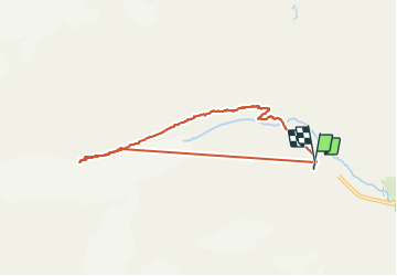

Length
7.8 km

Max alt
2491 m

Uphill gradient
744 m
Km-Effort
17.7 km

Min alt
1868 m

Downhill gradient
734 m
Boucle
Yes
Creation date :
2021-08-31 07:51:28.0
Updated on :
2021-08-31 18:13:39.653
4h42
Difficulty : Medium

FREE GPS app for hiking
 SityTrail
IGN / Geographical institutes
SityTrail Plus
The world is yours!
About
Trail Walking of 7.8 km to be discovered at Provence-Alpes-Côte d'Azur, Hautes-Alpes, Vallouise-Pelvoux. This trail is proposed by GOHIER.
Description
Arête de la moraine vertigineuse, assez impressionnante par endroits. Pas prise à la descente !
Avec Patou, Sylvie et Yvan.
740 m de dénivelé.
Positioning
Country:
France
Region :
Provence-Alpes-Côte d'Azur
Department/Province :
Hautes-Alpes
Municipality :
Vallouise-Pelvoux
Location:
Pelvoux
Start:(Dec)
Start:(UTM)
296008 ; 4976959 (32T) N.
Comments