


koestlach

philvor
User
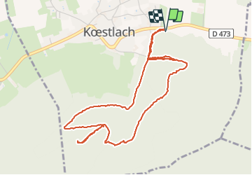

Length
5.5 km

Max alt
660 m

Uphill gradient
213 m
Km-Effort
8.3 km

Min alt
482 m

Downhill gradient
213 m
Boucle
Yes
Creation date :
2021-09-01 12:49:03.636
Updated on :
2021-09-01 14:43:37.378
1h53
Difficulty : Medium

FREE GPS app for hiking
 SityTrail
IGN / Geographical institutes
SityTrail Plus
The world is yours!
About
Trail Walking of 5.5 km to be discovered at Grand Est, Haut-Rhin, Kœstlach. This trail is proposed by philvor.
Positioning
Country:
France
Region :
Grand Est
Department/Province :
Haut-Rhin
Municipality :
Kœstlach
Location:
Unknown
Start:(Dec)
Start:(UTM)
370488 ; 5262810 (32T) N.
Comments