


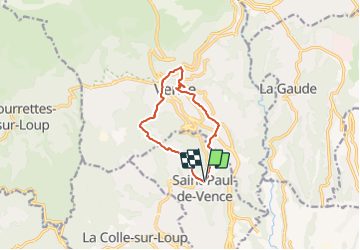

13.1 km | 22 km-effort


User


FREE GPS app for hiking
 SityTrail
IGN / Geographical institutes
SityTrail World
The world is yours!
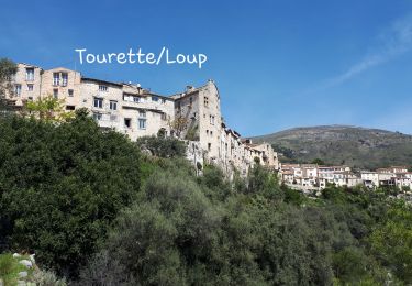
Trail Walking of 10.1 km to be discovered at Provence-Alpes-Côte d'Azur, Maritime Alps, Saint-Paul-de-Vence. This trail is proposed by pjjrevrard.
St-Paul à Vence par le vallon aval du Melvan, la Chapelle Ste-Elisabeth, le conservatoire de musique de Vence. Retour depuis le centre historique par la Chapelle du Rosaire et le vallon amont du Melvan

Walking
On foot
On foot

Mountain bike
Walking
Walking
Walking
Walking
Walking