


73 - BONNEVAL SUR ARC -

AndreLACOMBE
User

Length
6.4 km

Max alt
3046 m

Uphill gradient
508 m
Km-Effort
13.2 km

Min alt
2531 m

Downhill gradient
509 m
Boucle
Yes
Creation date :
2021-09-06 07:46:29.781
Updated on :
2021-09-06 14:29:37.952
6h06
Difficulty : Medium

FREE GPS app for hiking
 SityTrail
IGN / Geographical institutes
SityTrail Plus
The world is yours!
About
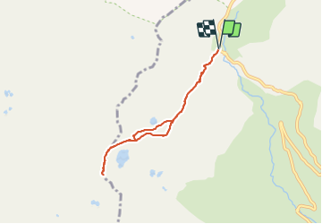
Trail Walking of 6.4 km to be discovered at Auvergne-Rhône-Alpes, Savoy, Bonneval-sur-Arc. This trail is proposed by AndreLACOMBE.
Description
Départ du Pont de la Neige pour monter au Col des Fours et à la Pointe des Fours (3070 m). Très belle balade, accessible à tous.
Positioning
Country:
France
Region :
Auvergne-Rhône-Alpes
Department/Province :
Savoy
Municipality :
Bonneval-sur-Arc
Location:
Unknown
Start:(Dec)
Start:(UTM)
345650 ; 5030023 (32T) N.
Comments